
File:FAA JFK Airport map 2011.svg

Size of this PNG preview of this SVG file: 390 × 599 pixels. Other resolutions: 156 × 240 pixels | 312 × 480 pixels | 500 × 768 pixels | 667 × 1,024 pixels | 1,334 × 2,048 pixels | 605 × 929 pixels.
Original file (SVG file, nominally 605 × 929 pixels, file size: 1.36 MB)
| This is a file from the Wikimedia Commons. Information from its description page there is shown below. Commons is a freely licensed media file repository. You can help. |

Summary
| Description |
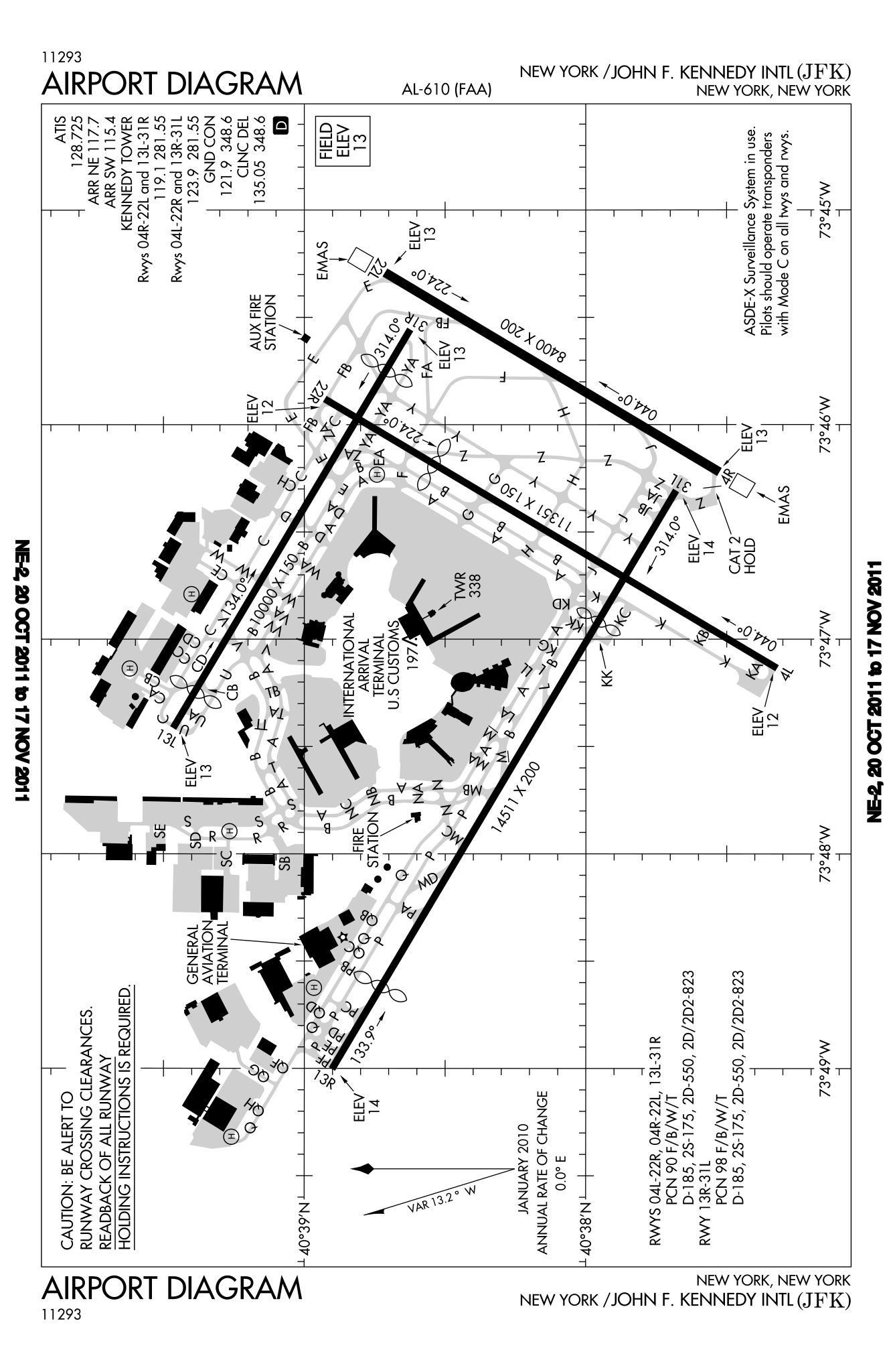
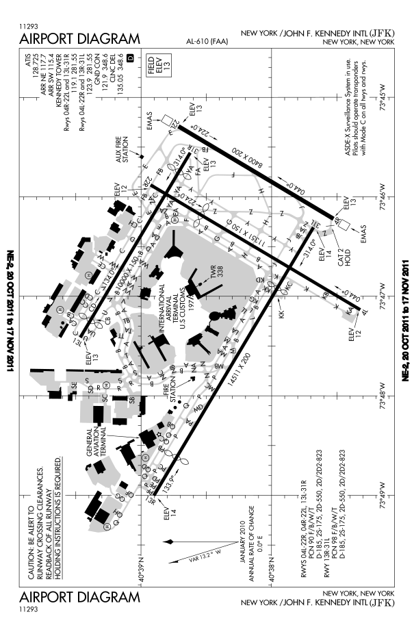
English: FAA diagram for John F. Kennedy International Airport in Queens, New York, United States. |
| Date | |
| Source |
Website: http://www.avn.faa.gov/digital_tpp.asp Image: http://www.avn.faa.gov/d-tpp/0812/00610AD.PDF (changes every 28 days, see article for current link) |
| Author | National Aeronautical Charting Office (NACO), a department of the U.S. Federal Aviation Administration (FAA). |
| Permission (Reusing this file) |
Public Domain |
Licensing
This image or file is a work of a Federal Aviation Administration employee, taken or made as part of that person's official duties. As a work of the U.S. federal government, the image is in the public domain in the United States.
|
 |
File history
Click on a date/time to view the file as it appeared at that time.
| Date/Time | Thumbnail | Dimensions | User | Comment | |
|---|---|---|---|---|---|
| current | 22:46, 20 October 2011 | | 605 × 929 (1.36 MB) | Bluefist | New version as of October 20, 2011. |
| 21:39, 1 March 2010 |  | 484 × 743 (709 KB) | Atmoz | upload new version | |
| 23:29, 13 November 2008 |  | 379 × 576 (760 KB) | Phongn | {{Information |Description={{en|1=FAA diagram of JFK.}} |Source=http://www.avn.faa.gov/digital_tpp.asp |Author=Federal Aviation Administration |Date= |Permission= |other_versions= }} <!--{{ImageUpload|full}}--> |
File usage
There are no pages that use this file.
Global file usage
The following other wikis use this file:
- Usage on bn.wikipedia.org
- Usage on en.wikipedia.org
- Usage on ko.wikipedia.org
- Usage on ms.wikipedia.org
- Usage on ta.wikipedia.org
- Usage on th.wikipedia.org
- Usage on uk.wikipedia.org