
File:2016-Brussels-Bombings-OpenStreetMap.png

Size of this preview: 800 × 521 pixels. Other resolutions: 320 × 208 pixels | 640 × 417 pixels | 1,024 × 667 pixels | 1,280 × 834 pixels | 2,560 × 1,668 pixels | 4,924 × 3,208 pixels.
Original file (4,924 × 3,208 pixels, file size: 19.66 MB, MIME type: image/png)
| This is a file from the Wikimedia Commons. Information from its description page there is shown below. Commons is a freely licensed media file repository. You can help. |
| Description |
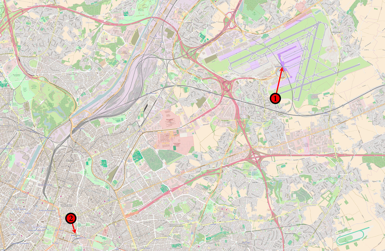
English: Map of the March 2016 Brussels bombings in relation to each other. (1) 08:00 : Concourse B of Brussels Airport. (2) 09:15 : Brussels Maelbeek metro station |
|||
| Date | ||||
| Source | Base map from OpenStreetMap | |||
| Author | Veggies | |||
| Permission (Reusing this file) |
This file is licensed under the Creative Commons Attribution-Share Alike 2.0 Generic license.
|
File history
Click on a date/time to view the file as it appeared at that time.
| Date/Time | Thumbnail | Dimensions | User | Comment | |
|---|---|---|---|---|---|
| current | 23:05, 22 March 2016 | | 4,924 × 3,208 (19.66 MB) | Veggies | {{Information |Description ={{en|1=Map of the March 2016 Brussels bombings in relation to each other.<br /> '''(1)''' 08:00 : Concourse B of Brussels Airport.<br />'''(2)''' 09:15 : ''Brussels Maelbeek metro station''}} |Source =Base map fro... |
File usage
The following page uses this file:
Global file usage
The following other wikis use this file:
- Usage on ar.wikipedia.org
- Usage on az.wikipedia.org
- Usage on ca.wikipedia.org
- Usage on da.wikipedia.org
- Usage on en.wikipedia.org
- Usage on et.wikipedia.org
- Usage on fo.wikipedia.org
- Usage on ga.wikipedia.org
- Usage on hi.wikipedia.org
- Usage on hu.wikipedia.org
- Usage on lt.wikipedia.org
- Usage on lv.wikipedia.org
- Usage on no.wikipedia.org
- Usage on pl.wikipedia.org
- Usage on pt.wikipedia.org
- Usage on sco.wikipedia.org
- Usage on ta.wikipedia.org
- Usage on tr.wikipedia.org
- Usage on vi.wikipedia.org
- Usage on www.wikidata.org
- Usage on zh.wikipedia.org