
File:Alicante-loc.svg

Size of this PNG preview of this SVG file: 593 × 599 pixels. Other resolutions: 237 × 240 pixels | 475 × 480 pixels | 760 × 768 pixels | 1,013 × 1,024 pixels | 2,026 × 2,048 pixels | 2,134 × 2,157 pixels.
Original file (SVG file, nominally 2,134 × 2,157 pixels, file size: 275 KB)
| This is a file from the Wikimedia Commons. Information from its description page there is shown below. Commons is a freely licensed media file repository. You can help. |
Summary
| Description |
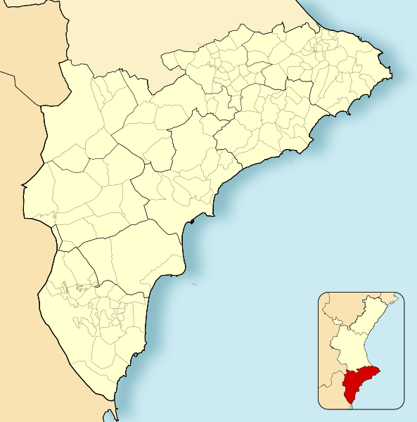
English: Location map of Province of Alicante
Equirectangular projection, N/S stretching 130 %. Geographic limits of the map:
Español: Mapa de localización de la Provincia de Alicante
Proyección equirrectangular (cilíndrica equidistante), N/S estirada 130 %. Límites geográficos del mapa:
|
|
| Date | ||
| Source | Own work based on: EspañaLoc.svg | |
| Author | Miguillen | |
| SVG development | This locator map was created with Adobe Illustrator, and with Inkscape.
|
Licensing
Miguillen, the copyright holder of this work, hereby publishes it under the following license:
This file is licensed under the Creative Commons Attribution-Share Alike 3.0 Unported license.
Attribution: Miguillen
- You are free:
- to share – to copy, distribute and transmit the work
- to remix – to adapt the work
- Under the following conditions:
- attribution – You must give appropriate credit, provide a link to the license, and indicate if changes were made. You may do so in any reasonable manner, but not in any way that suggests the licensor endorses you or your use.
- share alike – If you remix, transform, or build upon the material, you must distribute your contributions under the same or compatible license as the original.
File history
Click on a date/time to view the file as it appeared at that time.
| Date/Time | Thumbnail | Dimensions | User | Comment | |
|---|---|---|---|---|---|
| current | 15:46, 8 December 2010 | | 2,134 × 2,157 (275 KB) | Miguillen | colores |
| 16:58, 16 November 2010 |  | 2,134 × 2,157 (216 KB) | Miguillen | == {{int:filedesc}} == {{Information |Description={{en|Location map of Province of Alicante}} Equirectangular projection, N/S stretching 130 %. Geographic limits of the map: * N: ° N * S: ° N * W: ° O * E: ° E {{es|M |
File usage
The following 4 pages use this file:
Global file usage
The following other wikis use this file:
- Usage on ar.wikipedia.org
- Usage on ast.wikipedia.org
- Usage on ba.wikipedia.org
- Usage on ceb.wikipedia.org
- Usage on en.wikipedia.org
- Elche
- Guardamar del Segura
- Xàbia
- Altea
- Novelda
- Villena
- Santa Pola
- Calpe
- Ibi, Spain
- Cocentaina
- Benejúzar
- Muro de Alcoy
- Pinoso
- Pilar de la Horadada
- La Vall de Gallinera
- Moraira
- Lucentum
- Villamartin
- Benissa
- Teulada, Spain
- Lorcha, Spain
- Jalón
- Bigastro
- Callosa de Segura
- San Miguel de Salinas
- Agost
- Busot
- Gorga, Spain
- Mutxamel
- Salinas, Alicante
- Sax, Alicante
- Pedreguer
- 1992 UCI Road World Championships
- Module:Location map/data/Spain Province of Alicante/doc
- University of Orihuela
- Lycée Français d'Alicante
- Camino de Beniel
- Module:Location map/data/Spain Province of Alicante
- Barbarroja (Alicante)
- La Murada
- 2022 Segunda División RFEF play-offs
- Usage on eo.wikipedia.org
View more global usage of this file.