
File:Angola Map.jpg
Size of this preview: 482 × 599 pixels. Other resolutions: 193 × 240 pixels | 386 × 480 pixels | 618 × 768 pixels | 1,030 × 1,280 pixels.
Original file (1,030 × 1,280 pixels, file size: 283 KB, MIME type: image/jpeg)
| This is a file from the Wikimedia Commons. Information from its description page there is shown below. Commons is a freely licensed media file repository. You can help. |
| Description |
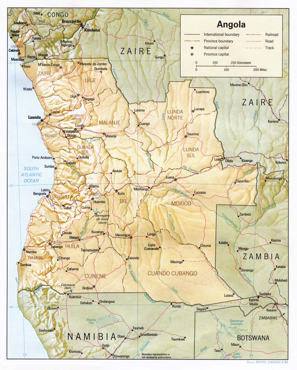
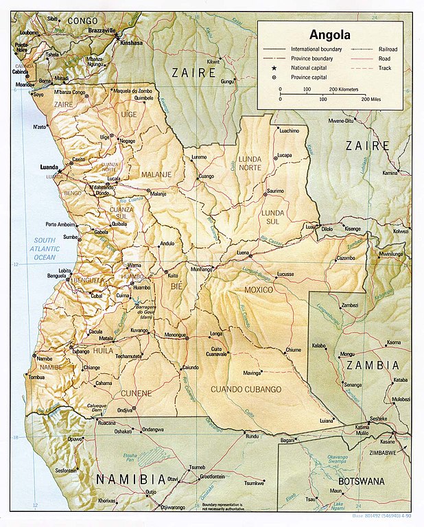
English: Shaded relief map of Angola. |
|||
| Date | ||||
| Source | [1] from the Perry-Castañeda Library Map Collection. | |||
| Author | CIA | |||
| Permission (Reusing this file) |
|

![[1]](http://www.lib.utexas.edu/maps/africa/angola_rel90.jpg)
File history
Click on a date/time to view the file as it appeared at that time.
| Date/Time | Thumbnail | Dimensions | User | Comment | |
|---|---|---|---|---|---|
| current | 11:32, 21 February 2006 | | 1,030 × 1,280 (283 KB) | Lupo | Shaded relief map of Angola. Source: [http://www.lib.utexas.edu/maps/africa/angola_rel90.jpg] from the [http://www.lib.utexas.edu/maps/angola.html Perry-Castañeda Library Map Collection]. {{PD-USGov-CIA}} Category:Maps of Angola |
File usage
The following page uses this file:
Global file usage
The following other wikis use this file:
- Usage on ar.wikipedia.org
- Usage on ast.wikipedia.org
- Usage on ca.wikipedia.org
- Usage on ckb.wikipedia.org
- Usage on de.wikipedia.org
- Usage on en.wikipedia.org
- Usage on es.wikipedia.org
- Usage on eu.wikipedia.org
- Usage on fa.wikipedia.org
- Usage on fi.wikipedia.org
- Usage on fr.wikipedia.org
- Usage on hu.wikipedia.org
- Usage on id.wikipedia.org
- Usage on incubator.wikimedia.org
- Usage on it.wikipedia.org
- Usage on mzn.wikipedia.org
- Usage on nl.wikipedia.org
- Usage on ny.wikipedia.org
- Usage on pl.wikipedia.org
- Usage on pt.wikipedia.org
- Usage on ru.wikipedia.org
- Usage on sl.wikipedia.org
- Usage on tl.wikipedia.org
- Usage on tr.wikipedia.org
- Usage on uk.wikipedia.org
- Usage on vec.wikipedia.org
- Usage on www.wikidata.org
- Usage on wo.wikipedia.org
- Usage on zh.wikipedia.org