
File:Area code WY.png
No higher resolution available.
Area_code_WY.png (420 × 275 pixels, file size: 9 KB, MIME type: image/png)
| This is a file from the Wikimedia Commons. Information from its description page there is shown below. Commons is a freely licensed media file repository. You can help. |

|
This map image could be re-created using vector graphics as an SVG file. This has several advantages; see Commons:Media for cleanup for more information. If an SVG form of this image is available, please upload it and afterwards replace this template with
{{vector version available|new image name}}.
It is recommended to name the SVG file “Area code WY.svg”—then the template Vector version available (or Vva) does not need the new image name parameter. |
Summary
| Description |
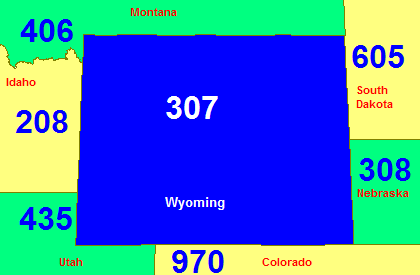
English: Map of Wyoming in blue with area codes for it and surrounding states. |
| Source |
English: U.S. Government's Tiger Map Server |
| Author |
Licensing
This image or file is a work of a United States Census Bureau employee, taken or made as part of that person's official duties. As a work of the U.S. federal government, the image is in the public domain.
|
 |
File history
Click on a date/time to view the file as it appeared at that time.
| Date/Time | Thumbnail | Dimensions | User | Comment | |
|---|---|---|---|---|---|
| current | 15:14, 25 July 2007 | | 420 × 275 (9 KB) | Rfc1394 | Add state names |
| 14:58, 11 March 2007 |  | 420 × 275 (7 KB) | Rfc1394 | Map of Wyoming in blue with area codes for it and surrounding states. From U.S. Government's [http://tiger.census.gov Tiger Map Server]. {{Pd-census}} Category:Maps of Wyoming Category:Area code maps of the United States |
File usage
The following page uses this file:
Global file usage
The following other wikis use this file:
- Usage on en.wikipedia.org
- Usage on zh.wikipedia.org