
File:Asahikawa in Hokkaido Prefecture Ja.svg

Size of this PNG preview of this SVG file: 600 × 600 pixels. Other resolutions: 240 × 240 pixels | 480 × 480 pixels | 768 × 768 pixels | 1,024 × 1,024 pixels | 2,048 × 2,048 pixels.
Original file (SVG file, nominally 800 × 800 pixels, file size: 112 KB)
| This is a file from the Wikimedia Commons. Information from its description page there is shown below. Commons is a freely licensed media file repository. You can help. |
Summary
| Description |
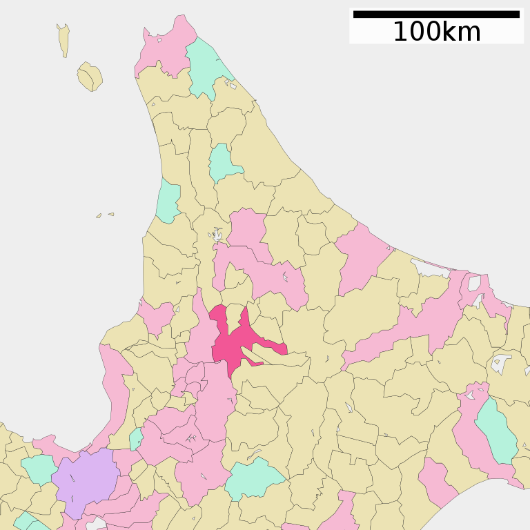
English: Location of Asahikawa in Hokkaido Prefecture
日本語: 北海道旭川市の位置 |
||
| Date | (UTC) | ||
| Source | ja:File:基礎自治体位置図 01204.svg | ||
| Author | ja:User:Lincun | ||
| Permission (Reusing this file) |
|
Licensing

|
Permission is granted to copy, distribute and/or modify this document under the terms of the GNU Free Documentation License, Version 1.2 or any later version published by the Free Software Foundation; with no Invariant Sections, no Front-Cover Texts, and no Back-Cover Texts. A copy of the license is included in the section entitled GNU Free Documentation License. |
This file is licensed under the Creative Commons Attribution-Share Alike 3.0 Unported license.
- You are free:
- to share – to copy, distribute and transmit the work
- to remix – to adapt the work
- Under the following conditions:
- attribution – You must give appropriate credit, provide a link to the license, and indicate if changes were made. You may do so in any reasonable manner, but not in any way that suggests the licensor endorses you or your use.
- share alike – If you remix, transform, or build upon the material, you must distribute your contributions under the same or compatible license as the original.
File history
Click on a date/time to view the file as it appeared at that time.
| Date/Time | Thumbnail | Dimensions | User | Comment | |
|---|---|---|---|---|---|
| current | 02:37, 18 November 2020 | | 800 × 800 (112 KB) | AichiWikiFixer | Fix colors. |
| 02:34, 18 November 2020 |  | 800 × 800 (112 KB) | AichiWikiFixer | Fix border for Yubetsu. | |
| 11:17, 17 November 2020 |  | 800 × 800 (111 KB) | AichiWikiFixer | Update | |
| 08:05, 30 April 2011 |  | 800 × 872 (46 KB) | Ranveig | Reverted to version as of 03:52, 6 May 2009 | |
| 02:36, 2 December 2009 |  | 400 × 604 (13 KB) | ASDFGHJ | update version | |
| 03:52, 6 May 2009 |  | 800 × 872 (46 KB) | Monaneko | {{Information |Description={{en|1=Location of Asahikawa in Hokkaido Prefecture}} {{ja|1=北海道旭川市の位置}} |Source=ja:File:基礎自治体位置図 01204.svg |Author=ja:User:Lincun |Date=2007-11-09 15:01 (UTC) |Permission=GFDL |other_ |
File usage
The following page uses this file:
Global file usage
The following other wikis use this file:
- Usage on azb.wikipedia.org
- Usage on de.wikipedia.org
- Usage on en.wikipedia.org
- Usage on fa.wikipedia.org
- Usage on fi.wikipedia.org
- Usage on id.wikipedia.org
- Usage on io.wikipedia.org
- Usage on it.wikipedia.org
- Usage on ko.wikipedia.org
- Usage on nl.wikipedia.org
- Usage on nn.wikipedia.org
- Usage on no.wikipedia.org
- Usage on pl.wikipedia.org
- Usage on ro.wikipedia.org
- Usage on sco.wikipedia.org
- Usage on sr.wikipedia.org
- Usage on sv.wikipedia.org
- Usage on tg.wikipedia.org
- Usage on th.wikipedia.org
- Usage on uk.wikipedia.org
- Usage on ur.wikipedia.org
- Usage on vi.wikipedia.org
- Usage on www.wikidata.org
- Usage on wuu.wikipedia.org
- Usage on zh-min-nan.wikipedia.org