
File:Ascain depuis la Rhune.jpg

Size of this preview: 800 × 450 pixels. Other resolutions: 320 × 180 pixels | 640 × 360 pixels | 1,024 × 576 pixels | 1,280 × 720 pixels | 2,560 × 1,440 pixels | 4,933 × 2,775 pixels.
Original file (4,933 × 2,775 pixels, file size: 9.17 MB, MIME type: image/jpeg)
| This is a file from the Wikimedia Commons. Information from its description page there is shown below. Commons is a freely licensed media file repository. You can help. |
Summary
| Description | ||
| Date | ||
| Source | Own work | |
| Author |
| |
| Attribution (required by the license) | © Guillaume Piolle / | |
| Camera location | | View this and other nearby images on: OpenStreetMap |
|---|
|


|
This image has been assessed under the valued image criteria and is considered the most valued image on Commons within the scope: Ascain. You can see its nomination here. |
Licensing
I, the copyright holder of this work, hereby publish it under the following license:
This file is licensed under the Creative Commons Attribution 3.0 Unported license.
- You are free:
- to share – to copy, distribute and transmit the work
- to remix – to adapt the work
- Under the following conditions:
- attribution – You must give appropriate credit, provide a link to the license, and indicate if changes were made. You may do so in any reasonable manner, but not in any way that suggests the licensor endorses you or your use.
File history
Click on a date/time to view the file as it appeared at that time.
| Date/Time | Thumbnail | Dimensions | User | Comment | |
|---|---|---|---|---|---|
| current | 13:20, 9 June 2013 | | 4,933 × 2,775 (9.17 MB) | Hohum | Levels |
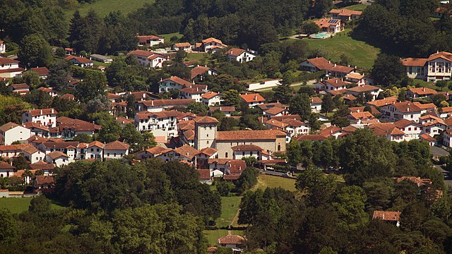
| 10:02, 9 June 2013 |  | 4,933 × 2,775 (8.72 MB) | Eusebius | {{Information |Description ={{en|1=The village of {{w|Ascain}}, seen from the top of {{w|Larrun}}.}} {{fr|1=Le village d'Ascain, vu du sommet de la Rhune.}} |Source ={{own}} |Author ={{User:Eusebius/Cr... |
File usage
The following page uses this file:
Global file usage
The following other wikis use this file:
- Usage on ca.wikipedia.org
- Usage on ce.wikipedia.org
- Usage on de.wikipedia.org
- Usage on en.wikipedia.org
- Usage on es.wikipedia.org
- Usage on eu.wikipedia.org
- Usage on eu.wikibooks.org
- Usage on fr.wikipedia.org
- Usage on fr.wikivoyage.org
- Usage on hu.wikipedia.org
- Usage on it.wikipedia.org
- Usage on ku.wikipedia.org
- Usage on lld.wikipedia.org
- Usage on mg.wikipedia.org
- Usage on oc.wikipedia.org
- Usage on ro.wikipedia.org
- Usage on sh.wikipedia.org
- Usage on sk.wikipedia.org
- Usage on sr.wikipedia.org
- Usage on uk.wikipedia.org
- Usage on uz.wikipedia.org
- Usage on vec.wikipedia.org
- Usage on vo.wikipedia.org
- Usage on www.wikidata.org
- Usage on zh-min-nan.wikipedia.org
- Usage on zh.wikipedia.org