
File:Australia New South Wales location map.svg

Original file (SVG file, nominally 1,885 × 1,670 pixels, file size: 569 KB)
| This is a file from the Wikimedia Commons. Information from its description page there is shown below. Commons is a freely licensed media file repository. You can help. |
Summary
| Description |
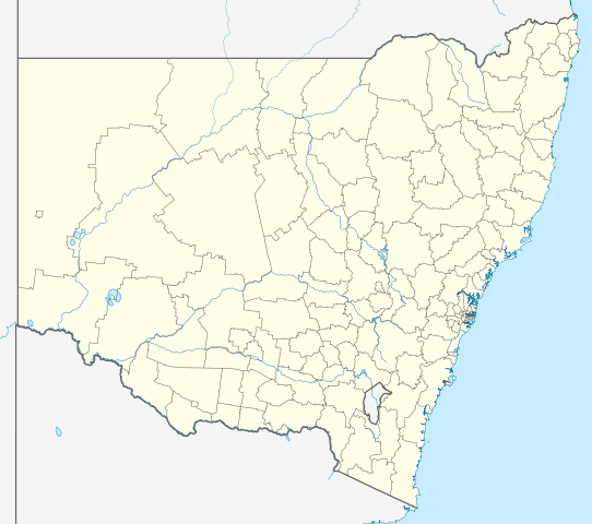
Quadratische Plattkarte, N-S-Streckung 119 %. Geographische Begrenzung der Karte:
Equirectangular projection, N/S stretching 119 %. Geographic limits of the map:
|
|
| Date | ||
| Source |
Own work, using |
|
| Author | NordNordWest | |
| Permission (Reusing this file) |
This file is licensed under the Creative Commons Attribution-Share Alike 3.0 Germany license.
 This file is licensed under the Creative Commons Attribution-Share Alike 3.0 Germany license.
|
|
| Other versions | Derivative works of this file: Australia New South Wales with LGA names.svg |


|
This map has been made or improved in the German Kartenwerkstatt (Map Lab). You can propose maps to improve as well.
|
File history
Click on a date/time to view the file as it appeared at that time.
| Date/Time | Thumbnail | Dimensions | User | Comment | |
|---|---|---|---|---|---|
| current | 22:05, 4 April 2010 | | 1,885 × 1,670 (569 KB) | Chumwa | Reverted to version as of 21:16, 3 February 2010 |
| 19:52, 4 April 2010 |  | 1,885 × 1,670 (351 KB) | Roke~commonswiki | local government low saliance, dont appear on general use maps | |
| 21:16, 3 February 2010 |  | 1,885 × 1,670 (569 KB) | NordNordWest | + | |
| 20:48, 28 January 2010 |  | 1,885 × 1,670 (351 KB) | NordNordWest | ={{int:filedesc}}== {{Information |Description= {{de|Positionskarte von New South Wales, Australien}} Quadratische Plattkarte, N-S-Streckung 119 %. Geographische Begrenzung der Karte: * N: 27.9° S * S: 37.8° S |
File usage
The following 2 pages use this file:
Global file usage
The following other wikis use this file:
- Usage on af.wikipedia.org
- Usage on als.wikipedia.org
- Usage on ar.wikipedia.org
- Usage on ast.wikipedia.org
- Usage on ba.wikipedia.org
- Usage on be.wikipedia.org
- Usage on bg.wikipedia.org
- Usage on bn.wikipedia.org
- Usage on ceb.wikipedia.org
- Usage on cs.wikipedia.org
- Usage on de.wikipedia.org
- Sydney
- Thredbo
- Port Macquarie
- Byron Bay
- Newcastle (New South Wales)
- Kingsford Smith International Airport
- Orange (New South Wales)
- Botany Bay
- Namadgi-Nationalpark
- Booderee-Nationalpark
- Wollongong
- Belmont (New South Wales)
- Cape Byron
- Yass
- Nimbin
- Cowra
- Walgett
- Katoomba
- Coffs Harbour
- Tamworth (Australien)
- Deniliquin
- Port Stephens
- Bega (Australien)
- Broken Hill
View more global usage of this file.