
File:Australia Victoria location map highways.svg

Size of this PNG preview of this SVG file: 800 × 563 pixels. Other resolutions: 320 × 225 pixels | 640 × 450 pixels | 1,024 × 720 pixels | 1,280 × 900 pixels | 2,560 × 1,800 pixels | 1,375 × 967 pixels.
Original file (SVG file, nominally 1,375 × 967 pixels, file size: 729 KB)
| This is a file from the Wikimedia Commons. Information from its description page there is shown below. Commons is a freely licensed media file repository. You can help. |
| Description |
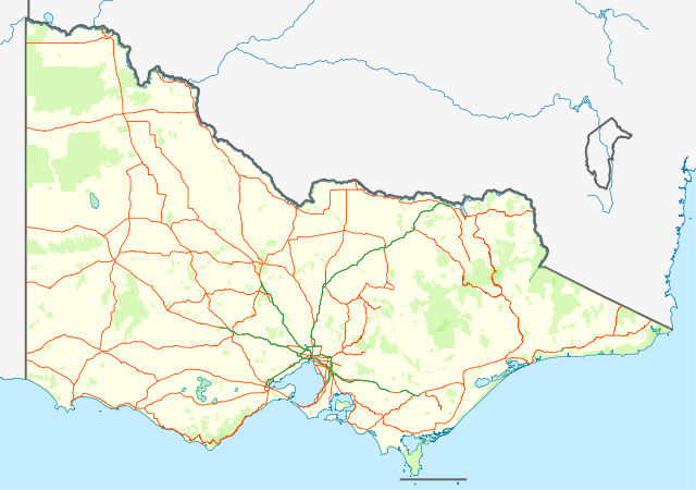
English: Location map with highways (in Orange) and freeways (in Green) of Victoria, Australia. Also shows state forests and national parks.
Equirectangular projection, N/S stretching 124 %. Geographic limits of the map:
Deutsch: Positionskarte mit Highways (Straße zwischen Großstädte; in Orange) and Freeways (~Autobahnen; in Grün) von Victoria, Australien. Auch mit Nationalparks
Quadratische Plattkarte, N-S-Streckung 124 %. Geographische Begrenzung der Karte:
|
| Date | (UTC) |
| Source | |
| Author |
|
| This is a retouched picture, which means that it has been digitally altered from its original version. Modifications: show roads and national parks. The original can be viewed here: Australia Victoria location map blank.svg:
|
I, the copyright holder of this work, hereby publish it under the following license:
This file is licensed under the Creative Commons Attribution-Share Alike 3.0 Unported license.
- You are free:
- to share – to copy, distribute and transmit the work
- to remix – to adapt the work
- Under the following conditions:
- attribution – You must give appropriate credit, provide a link to the license, and indicate if changes were made. You may do so in any reasonable manner, but not in any way that suggests the licensor endorses you or your use.
- share alike – If you remix, transform, or build upon the material, you must distribute your contributions under the same or compatible license as the original.
Original upload log
This image is a derivative work of the following images:
- File:Australia_Victoria_location_map_blank.svg licensed with Cc-by-sa-3.0
- 2010-04-10T01:20:08Z Roke 1375x967 (279504 Bytes) {{Information |Description={{de|Positionskarte von [[:de:Victoria (Australien)|Victoria]], [[:de:Australien|Australien]]}} Quadratische Plattkarte, N-S-Streckung 124 %. Geographische Begrenzung der Karte: * N: 33.8° S * S: 3
Uploaded with derivativeFX
File history
Click on a date/time to view the file as it appeared at that time.
| Date/Time | Thumbnail | Dimensions | User | Comment | |
|---|---|---|---|---|---|
| current | 13:58, 25 February 2011 | | 1,375 × 967 (729 KB) | Cassowary | {{Information |Description={{en|Location map with highways (in Orange) and freeways (in Green) of Victoria, Australia. Also shows state forests and national parks.}} Equirectangular projection, N/S stretchi |
File usage
The following 3 pages use this file:
Global file usage
The following other wikis use this file:
- Usage on bs.wikipedia.org
- Usage on ceb.wikipedia.org
- Usage on en.wikipedia.org
- Usage on es.wikipedia.org
- Usage on fa.wikipedia.org
- Usage on kn.wikipedia.org
- Usage on pl.wikipedia.org
- Usage on pl.wikibooks.org
- Usage on shn.wikipedia.org
- Usage on si.wikipedia.org
- Usage on sl.wikipedia.org
- Usage on tr.wikipedia.org
- Usage on uz.wikipedia.org
- Usage on war.wikipedia.org