
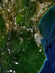
File:Barahona 71.16445W 18.21020N.jpg

Size of this preview: 449 × 600 pixels. Other resolutions: 179 × 240 pixels | 359 × 480 pixels | 958 × 1,280 pixels.
Original file (958 × 1,280 pixels, file size: 223 KB, MIME type: image/jpeg)
| This is a file from the Wikimedia Commons. Information from its description page there is shown below. Commons is a freely licensed media file repository. You can help. |
Summary
| Description | |
| Date | 15 May 2005 (original upload date) |
| Source | NASA World Wind screenshot. |
| Author | NASA World Wind screenshot. |
| This image is in the public domain because it is a screenshot from NASA’s globe software World Wind using a public domain layer, such as Blue Marble, MODIS, Landsat, SRTM, USGS or GLOBE.
|
 |
File history
Click on a date/time to view the file as it appeared at that time.
| Date/Time | Thumbnail | Dimensions | User | Comment | |
|---|---|---|---|---|---|
| current | 00:01, 22 August 2016 | | 958 × 1,280 (223 KB) | SteinsplitterBot | Bot: Image rotated by 270° |
| 23:14, 15 May 2005 |  | 1,280 × 958 (222 KB) | Rex | NASA World Wind screenshot. {{PD-USGov-NASA}} Category:Maps of the Dominican Republic |
File usage
The following page uses this file:
Global file usage
The following other wikis use this file:
- Usage on ar.wikipedia.org
- Usage on arz.wikipedia.org
- Usage on ca.wikipedia.org
- Usage on ceb.wikipedia.org
- Usage on de.wikivoyage.org
- Usage on en.wikipedia.org
- Usage on en.wikivoyage.org
- Usage on es.wikipedia.org
- Usage on eu.wikipedia.org
- Usage on fa.wikipedia.org
- Usage on fr.wikipedia.org
- Usage on it.wikipedia.org
- Usage on ko.wikipedia.org
- Usage on mt.wikipedia.org
- Usage on pl.wikipedia.org
- Usage on ru.wikipedia.org
- Usage on sv.wikipedia.org
- Usage on uk.wikipedia.org
- Usage on ur.wikipedia.org
- Usage on www.wikidata.org
- Usage on zh.wikipedia.org