
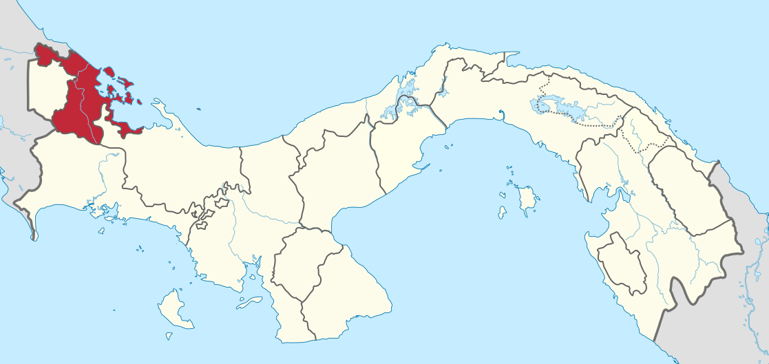
File:Bocas del Toro in Panama.svg

Size of this PNG preview of this SVG file: 800 × 379 pixels. Other resolutions: 320 × 152 pixels | 640 × 303 pixels | 1,024 × 485 pixels | 1,280 × 606 pixels | 2,560 × 1,212 pixels | 1,117 × 529 pixels.
Original file (SVG file, nominally 1,117 × 529 pixels, file size: 424 KB)
| This is a file from the Wikimedia Commons. Information from its description page there is shown below. Commons is a freely licensed media file repository. You can help. |
Summary
.svg)
.svg)
.svg)
.svg)
.svg)
.svg)
.svg)

-en.svg)

.svg)
.svg)
.svg)

_(US48).svg)
_(small_islands_magnified)_(-mini_map_-rivers).svg)
.svg)
_(extra_close)_(US48).svg)
.svg)
_(zoom).svg)

.svg)


_(UNMIK).svg)
.svg)
_(disputed_hatched).svg)
_(claimed_and_disputed_hatched).svg)
.svg)
.svg)
_(%2Ball_claims_hatched).svg)

.svg)
_(shade).svg)
_(shade)_(special_marker).svg)
_(-mini_map).svg)
_(-mini_map).svg)
_(-mini_map).svg)


.svg)

.svg)
Licensing
I, the copyright holder of this work, hereby publish it under the following licenses:

|
Permission is granted to copy, distribute and/or modify this document under the terms of the GNU Free Documentation License, Version 1.2 or any later version published by the Free Software Foundation; with no Invariant Sections, no Front-Cover Texts, and no Back-Cover Texts. A copy of the license is included in the section entitled GNU Free Documentation License. |
This file is licensed under the Creative Commons Attribution-Share Alike 3.0 Unported license.
- You are free:
- to share – to copy, distribute and transmit the work
- to remix – to adapt the work
- Under the following conditions:
- attribution – You must give appropriate credit, provide a link to the license, and indicate if changes were made. You may do so in any reasonable manner, but not in any way that suggests the licensor endorses you or your use.
- share alike – If you remix, transform, or build upon the material, you must distribute your contributions under the same or compatible license as the original.
You may select the license of your choice.

|
I'd greatly appreciate, that you attribute this media file to Wikimedia Commons, if used outside Wikipedia or Commons. For use in publications such as books, newspapers, blogs, websites, please insert here the following line:
|
File history
Click on a date/time to view the file as it appeared at that time.
| Date/Time | Thumbnail | Dimensions | User | Comment | |
|---|---|---|---|---|---|
| current | 17:10, 28 December 2020 | | 1,117 × 529 (424 KB) | Milenioscuro | new comarca: Naso Tjerdi |
| 13:38, 6 January 2014 |  | 1,246 × 628 (336 KB) | TUBS | ||
| 12:33, 4 November 2011 |  | 1,246 × 628 (614 KB) | TUBS | ||
| 12:30, 4 November 2011 |  | 1,246 × 628 (614 KB) | TUBS |
File usage
The following page uses this file:
Global file usage
The following other wikis use this file:
- Usage on ar.wikipedia.org
- Usage on be.wikipedia.org
- Usage on bg.wikipedia.org
- Usage on ca.wikipedia.org
- Usage on ceb.wikipedia.org
- Usage on cs.wikipedia.org
- Usage on de.wikipedia.org
- Usage on de.wikivoyage.org
- Usage on en.wikipedia.org
- Bocas del Toro Province
- Bocas Town, Bocas del Toro
- Almirante, Bocas del Toro
- Colón Island
- Changuinola
- Chiriquí Grande
- El Silencio, Panama
- Finca Cincuenta y Uno
- Guabito
- Punta Peña
- Valle del Risco
- Wikipedia:WikiProject Panama/Provincial templates
- Template:Bocas del Toro Province
- Bastimentos Island
- Cauchero
- Punta Laurel
- Tierra Oscura
- Teribe
- El Empalme, Bocas del Toro
- Las Tablas, Bocas del Toro
- Miramar, Bocas del Toro
- Punta Robalo
- Rambala
- Bocas del Toro District
- Changuinola District
- Chiriquí Grande District
- Bocas del Toro Archipelago
- Solarte Island
- Carenero Island
- Cristóbal Island
- Popa Island
- Cayo Agua Island
- Template:Bocas del Toro Archipelago
- Isla Bastimentos National Marine Park
- Salt Creek, Panama
- Cayos Zapatilla
- Cochigró
- La Gloria, Bocas del Toro
View more global usage of this file.