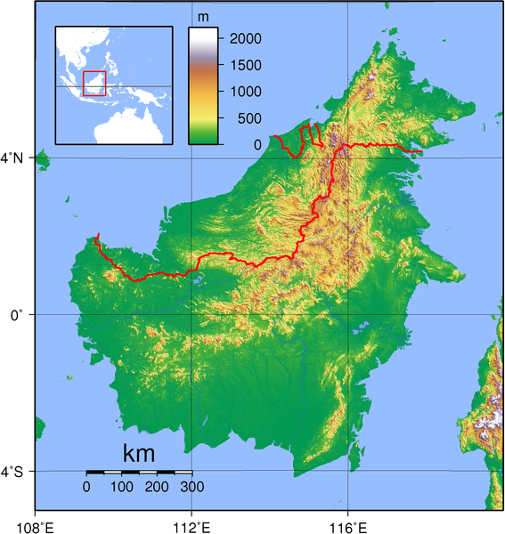
File:Borneo Topography.png

Size of this preview: 567 × 600 pixels. Other resolutions: 227 × 240 pixels | 454 × 480 pixels | 726 × 768 pixels | 968 × 1,024 pixels | 1,725 × 1,824 pixels.
Original file (1,725 × 1,824 pixels, file size: 2.52 MB, MIME type: image/png)
File history
Click on a date/time to view the file as it appeared at that time.
| Date/Time | Thumbnail | Dimensions | User | Comment | |
|---|---|---|---|---|---|
| current | 19:17, 1 September 2007 |  | 1,725 × 1,824 (2.52 MB) | Sadalmelik | Better data, better colours |
| 20:54, 3 June 2007 |  | 2,083 × 2,158 (1.67 MB) | Sadalmelik | {{Information |Description=Topographical map of Borneo. Created with GMT from publicly released GLOBE data[http://www.ngdc.noaa.gov/mgg/topo/globe.html]. |Source=self-made |Date=June 3, 2007 |Author= User:Sadalmelik }} Category:Maps of Malaysia |
File usage
The following page uses this file:
Global file usage
The following other wikis use this file:
- Usage on af.wikipedia.org
- Usage on ar.wikipedia.org
- Usage on az.wikipedia.org
- Usage on ban.wikipedia.org
- Usage on be-tarask.wikipedia.org
- Usage on be.wikipedia.org
- Usage on bg.wikipedia.org
- Usage on bn.wikipedia.org
- Usage on ca.wikipedia.org
- Usage on ceb.wikipedia.org
- Usage on de.wikipedia.org
- Usage on de.wikivoyage.org
- Usage on de.wiktionary.org
- Usage on el.wikipedia.org
- Usage on el.wiktionary.org
- Usage on en.wikipedia.org
- Borneo
- East Malaysia
- Talk:Borneo
- List of endemic birds of Borneo
- Outline of Malaysia
- User:Chickstarr404/Gather lists/13386 – "A Travelers Alphabet" by Stephen Runciman
- Wikipedia:Today's featured list/June 2021
- Wikipedia:Today's featured list/June 11, 2021
- Wikipedia:Main Page history/2021 June 11
- Wikipedia:Main Page history/2021 June 11b
- Phalaenopsis kapuasensis
- Phalaenopsis luteola
- Phalaenopsis modesta
- Phalaenopsis pantherina
- Phalaenopsis × singuliflora
- User:AryKun/Misc
- Naval Base Borneo
- User:Asang Lawai
- Template:User Dayak
- Usage on en.wikibooks.org
- Usage on en.wikinews.org
- Usage on eo.wikipedia.org
- Usage on es.wikipedia.org
- Usage on et.wikipedia.org
- Usage on eu.wikipedia.org
- Usage on fa.wikipedia.org
- Usage on fi.wikipedia.org
- Usage on fo.wikipedia.org
- Usage on frr.wikipedia.org
- Usage on fr.wikipedia.org
View more global usage of this file.

