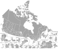
File:Canada Federal Ridings Map.svg

Size of this PNG preview of this SVG file: 767 × 600 pixels. Other resolutions: 307 × 240 pixels | 614 × 480 pixels | 982 × 768 pixels | 1,280 × 1,001 pixels | 2,560 × 2,002 pixels | 1,046 × 818 pixels.
Original file (SVG file, nominally 1,046 × 818 pixels, file size: 1.17 MB)
File history
Click on a date/time to view the file as it appeared at that time.
| Date/Time | Thumbnail | Dimensions | User | Comment | |
|---|---|---|---|---|---|
| current | 17:34, 30 October 2017 |  | 1,046 × 818 (1.17 MB) | DrRandomFactor | Fixed error with Gaspésie—Les Îles-de-la-Madeleine. The islands were incorrectly grouped with Manicougan, this has now been fixed. |
| 20:30, 24 October 2017 |  | 1,046 × 818 (1.17 MB) | DrRandomFactor | Fixed formatting errors in the Toronto inset. | |
| 06:20, 19 October 2017 |  | 1,046 × 818 (1.17 MB) | DrRandomFactor | Fixed formatting errors in inset boundaries. | |
| 06:10, 19 October 2017 |  | 1,046 × 818 (1.17 MB) | DrRandomFactor | New Format | |
| 02:54, 7 July 2017 |  | 3,254 × 2,768 (873 KB) | DrRandomFactor | Eliminated the party charts and used the Compound Path tool to make non-contiguous ridings more streamlined and grouped. | |
| 19:48, 3 May 2017 |  | 3,254 × 2,768 (928 KB) | DrRandomFactor | Adjusted boundaries in the Ottawa region for viewing purposes. | |
| 17:23, 2 April 2017 |  | 3,254 × 2,768 (932 KB) | DrRandomFactor | Fixed boundary issues between Brampton North and Centre in Mississauga. | |
| 19:57, 23 March 2017 |  | 3,254 × 2,768 (930 KB) | DrRandomFactor | Added additional insets for Prince Edward Island and Niagara Falls, as well as fixed boundary issues with Nova Scotia. | |
| 02:06, 23 March 2017 |  | 3,254 × 2,768 (899 KB) | DrRandomFactor | User created page with UploadWizard |
File usage
The following 2 pages use this file:
Global file usage
The following other wikis use this file:
- Usage on de.wikipedia.org
- Usage on en.wikipedia.org
- Usage on es.wikipedia.org
- Usage on fr.wikipedia.org
- Usage on pt.wikipedia.org
- Usage on zh.wikipedia.org
