
File:Canada location map 2 - lite.svg

Size of this PNG preview of this SVG file: 709 × 600 pixels. Other resolutions: 284 × 240 pixels | 568 × 480 pixels | 908 × 768 pixels | 1,211 × 1,024 pixels | 2,422 × 2,048 pixels | 1,114 × 942 pixels.
Original file (SVG file, nominally 1,114 × 942 pixels, file size: 279 KB)
| This is a file from the Wikimedia Commons. Information from its description page there is shown below. Commons is a freely licensed media file repository. You can help. |
Summary
| Description |
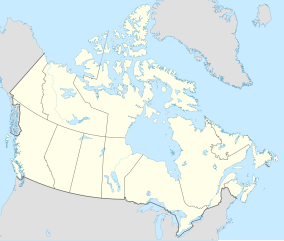
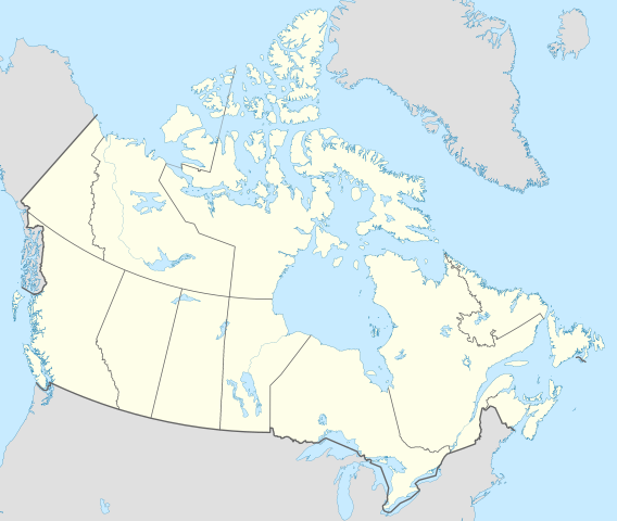
English: Location map of Canada with all five Great Lakes shown in full.
This is a lite version of the map with most rivers removed. |
| Date | |
| Source | Own work |
| Author | MapGrid |
| Other versions |
|
| SVG development |


Map Info
| Projection: | Lambert conformal conic |
|---|---|
| Datum: | WGS84 |
| Central Meridian: | 95.000000°W |
| Latitude of Origin: | 60.000000°N |
| Standard Parallel #1: | 49.000000°N |
| Standard Parallel #2: | 77.000000°N |
| x (%)= | 201.7818903*(((tan(pi*(90-$1)/360))*(((1+0.08181919084*sin(pi*$1/180))/(1-0.08181919084*sin(pi*$1/180)))^0.04090959542))^0.9007900864)*sin(0.01572175288*($2+95))+43.98563734
|
|---|---|
| y (%)= | 238.6252927*(((tan(pi*(90-$1)/360))*(((1+0.08181919084*sin(pi*$1/180))/(1-0.08181919084*sin(pi*$1/180)))^0.04090959542))^0.9007900864)*cos(0.01572175288*($2+95))-15.81495465
|
| $1: | latitude in degrees (positive for all locations in Canada). |
| $2: | longitude in degrees (negative for all locations in Canada). |
| x (%): | x coordinate expressed as percentage of image width (measured from left edge). |
| y (%): | y coordinate expressed as percentage of image height (measured from top edge). |
| x (px) | y (px) | x (%) | y (%) | Latitude | Longitude | |
|---|---|---|---|---|---|---|
| Top Left Corner: | 0.000 | 0.000 | 0.00 | 0.00 | 68.220310°N | 176.138684°W |
| Top Right Corner: | 1114.000 | 0.000 | 100.00 | 0.00 | 62.238635°N | 9.994317°W |
| Bottom Right Corner: | 1114.000 | 942.000 | 100.00 | 100.00 | 34.831244°N | 61.953430°W |
| Bottom Left Corner: | 0.000 | 942.000 | 0.00 | 100.00 | 37.392537°N | 121.850536°W |
| Centre: | 557.000 | 471.000 | 50.00 | 50.00 | 63.068962°N | 88.152750°W |
| Origin: | 490.000 | 541.000 | 43.99 | 57.43 | 60.000000°N | 95.000000°W |
| North Pole: | 490.000 | -148.977 | 43.99 | -15.81 | 90.000000°N | ⸻ |
| Thechàl Dhâl: | 67.523 | 368.241 | 6.06 | 39.09 | 61.022873°N | 138.564925°W |
Licensing
I, the copyright holder of this work, hereby publish it under the following license:
This file is licensed under the Creative Commons Attribution-Share Alike 4.0 International license.
- You are free:
- to share – to copy, distribute and transmit the work
- to remix – to adapt the work
- Under the following conditions:
- attribution – You must give appropriate credit, provide a link to the license, and indicate if changes were made. You may do so in any reasonable manner, but not in any way that suggests the licensor endorses you or your use.
- share alike – If you remix, transform, or build upon the material, you must distribute your contributions under the same or compatible license as the original.
File history
Click on a date/time to view the file as it appeared at that time.
| Date/Time | Thumbnail | Dimensions | User | Comment | |
|---|---|---|---|---|---|
| current | 17:36, 29 December 2020 | | 1,114 × 942 (279 KB) | MapGrid | Added an international boundary line between Canada and St Pierre & Miquelon (as per request). Slightly thinner provincial/territorial border to match new provincial/territorial locator maps. |
| 18:59, 25 December 2020 |  | 1,114 × 942 (279 KB) | MapGrid | Christmas Day edition... added the Nelson River | |
| 22:45, 22 November 2020 |  | 1,114 × 942 (269 KB) | MapGrid | Added Mackenzie River. And a few minor tweaks. | |
| 19:03, 15 November 2020 |  | 1,114 × 942 (264 KB) | MapGrid | Uploaded own work with UploadWizard |
File usage
The following 14 pages use this file:
Global file usage
The following other wikis use this file:
- Usage on azb.wikipedia.org
- Usage on bh.wikipedia.org
- Usage on en.wikipedia.org
- Geography of Canada
- Politics of Canada
- Economy of Canada
- Monarchy of Canada
- List of Canadian provincial and territorial symbols
- Music of Canada
- Same-sex marriage in Canada
- First Nations in Canada
- List of universities in Canada
- Index of Canada-related articles
- National Historic Sites of Canada
- Template:Subdivisions of Ontario
- Template:Administrative divisions of Quebec
- Template:Subdivisions of British Columbia
- List of current Canadian first ministers
- Egale Canada
- Same-sex marriage in Yukon
- List of extreme points of Canada
- Universities Canada
- Same-sex marriage in Ontario
- Same-sex marriage in Quebec
- Same-sex marriage in British Columbia
- Same-sex marriage in Manitoba
- Same-sex marriage in Nova Scotia
- List of universities and colleges in New Brunswick
- Same-sex marriage in Nunavut
- Same-sex marriage in Alberta
- Same-sex marriage in Saskatchewan
- Same-sex marriage in New Brunswick
- Same-sex marriage in Newfoundland and Labrador
- Same-sex marriage in Prince Edward Island
- Same-sex marriage in the Northwest Territories
- Civil unions in Quebec
- Members of the 38th Canadian Parliament and same-sex marriage
- Reference Re Same-Sex Marriage
- Civil Marriage Act
- Canadians for Equal Marriage
- Template:Subdivisions of Alberta
- Template:Same-sex marriage in Canada
- Template talk:Same-sex marriage in Canada
- Template:Subdivisions of New Brunswick
- Scouting and Guiding in Quebec
- List of colleges in Canada
- Scouting and Guiding in Canada
- LGBT rights in Canada
- Template:Subdivisions of Saskatchewan
- Template:Subdivisions of Nova Scotia
View more global usage of this file.