
File:Doggerland.svg

Size of this PNG preview of this SVG file: 545 × 600 pixels. Other resolutions: 218 × 240 pixels | 436 × 480 pixels | 698 × 768 pixels | 930 × 1,024 pixels | 1,860 × 2,048 pixels.
Original file (SVG file, nominally 545 × 600 pixels, file size: 165 KB)
| This is a file from the Wikimedia Commons. Information from its description page there is shown below. Commons is a freely licensed media file repository. You can help. |
Summary
| Description |
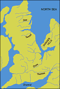
English: An image of the area known as Doggerland which connected the British Isles and the European continent. Loosely based on two images, found at http://www.bevpease.force9.co.uk/p.Flood_files/image002.jpg and http://humanities.exeter.ac.uk/archaeology/research/projects/title_89282_en.html, (now archived at https://web.archive.org/web/20220420042919/http://humanities.exeter.ac.uk/archaeology/research/projects/title_89282_en.html) however drawing work was all done in Illustrator by myself. Norway has been excluded from the map.
Deutsch: Paläogeografische Darstellung der Nordsee vor etwa 9000 Jahren, bevor Doggerland vom Festland getrennt wurde.
|
| Date | |
| Source | Own work |
| Author | Max Naylor |
W3C-validity not checked.
Licensing
I, the copyright holder of this work, hereby publish it under the following licenses:
This file is licensed under the Creative Commons Attribution-Share Alike 3.0 Unported license.
- You are free:
- to share – to copy, distribute and transmit the work
- to remix – to adapt the work
- Under the following conditions:
- attribution – You must give appropriate credit, provide a link to the license, and indicate if changes were made. You may do so in any reasonable manner, but not in any way that suggests the licensor endorses you or your use.
- share alike – If you remix, transform, or build upon the material, you must distribute your contributions under the same or compatible license as the original.

|
Permission is granted to copy, distribute and/or modify this document under the terms of the GNU Free Documentation License, Version 1.2 or any later version published by the Free Software Foundation; with no Invariant Sections, no Front-Cover Texts, and no Back-Cover Texts. A copy of the license is included in the section entitled GNU Free Documentation License. |
You may select the license of your choice.
File history
Click on a date/time to view the file as it appeared at that time.
| Date/Time | Thumbnail | Dimensions | User | Comment | |
|---|---|---|---|---|---|
| current | 18:59, 19 October 2014 | | 545 × 600 (165 KB) | Ras67 | frame removed |
| 13:06, 24 June 2011 |  | 348 × 383 (132 KB) | Ciaurlec | Changed colours to uniform all the palaeogeographic maps | |
| 00:52, 22 February 2009 |  | 348 × 383 (125 KB) | Maxí | {{Information |Description={{en|1=An image of the area known as Doggerland which connected the British Isles and the European continent. Loosely based on two images, found [http://www.bevpease.force9.co.uk/p.Flood_files/image002.jpg here] and [http://soga |
File usage
The following 2 pages use this file:
Global file usage
The following other wikis use this file:
- Usage on ar.wikipedia.org
- Usage on be.wikipedia.org
- Usage on ca.wikipedia.org
- Usage on cs.wikipedia.org
- Usage on cy.wikipedia.org
- Usage on da.wikipedia.org
- Usage on de.wikipedia.org
- Usage on el.wikipedia.org
- Usage on en.wikipedia.org
- Usage on eo.wikipedia.org
- Usage on es.wikipedia.org
- Usage on et.wikipedia.org
- Usage on eu.wikipedia.org
- Usage on fa.wikipedia.org
- Usage on fi.wikipedia.org
- Usage on frr.wikipedia.org
- Usage on fr.wikipedia.org
- Usage on fr.wiktionary.org
- Usage on he.wikipedia.org
- Usage on hr.wikipedia.org
- Usage on hu.wikipedia.org
- Usage on hy.wikipedia.org
View more global usage of this file.