
File:GrandDuchyofTuscany1700.png
No higher resolution available.
GrandDuchyofTuscany1700.png (375 × 228 pixels, file size: 6 KB, MIME type: image/png)
| This is a file from the Wikimedia Commons. Information from its description page there is shown below. Commons is a freely licensed media file repository. You can help. |
Summary
| Description |
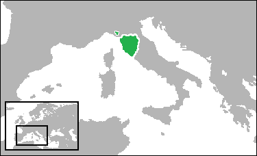
English: Locator map showing the Grand Duchy of Tuscany in the year 1700. (Territory was largely the same through its entire existence) (Partially based on Euratlas map of Europe - 1800.) |
| Date | |
| Source | Own work |
| Author | Gabagool |
Licensing
I, the copyright holder of this work, hereby publish it under the following license:
This file is licensed under the Creative Commons Attribution 3.0 Unported license.
- You are free:
- to share – to copy, distribute and transmit the work
- to remix – to adapt the work
- Under the following conditions:
- attribution – You must give appropriate credit, provide a link to the license, and indicate if changes were made. You may do so in any reasonable manner, but not in any way that suggests the licensor endorses you or your use.
File history
Click on a date/time to view the file as it appeared at that time.
| Date/Time | Thumbnail | Dimensions | User | Comment | |
|---|---|---|---|---|---|
| current | 18:52, 7 July 2009 | | 375 × 228 (6 KB) | Gabagool | border |
| 20:08, 29 June 2009 |  | 375 × 228 (6 KB) | Gabagool | added enclave | |
| 16:38, 26 June 2009 |  | 375 × 228 (6 KB) | Gabagool | {{Information |Description={{en|1=Locator map showing the Grand Duchy of Tuscany in the year 1700. (Territory was largely the same through its entire existence)<br>(Partially based on Euratlas map of Europe - 1800.)}} |Source=Own work by uploader |Author= |
File usage
The following page uses this file:
Global file usage
The following other wikis use this file:
- Usage on ar.wikipedia.org
- Usage on da.wikipedia.org
- Usage on eu.wikipedia.org