
File:Grossraum Basel.png
Size of this preview: 800 × 571 pixels. Other resolutions: 320 × 228 pixels | 640 × 457 pixels | 1,024 × 731 pixels | 1,280 × 914 pixels | 1,486 × 1,061 pixels.
Original file (1,486 × 1,061 pixels, file size: 1.28 MB, MIME type: image/png)
| This is a file from the Wikimedia Commons. Information from its description page there is shown below. Commons is a freely licensed media file repository. You can help. |

|
File:Grossraum Basel.svg is a vector version of this file. It should be used in place of this PNG file when not inferior.
File:Grossraum Basel.png → File:Grossraum Basel.svg
For more information, see Help:SVG. |
 |
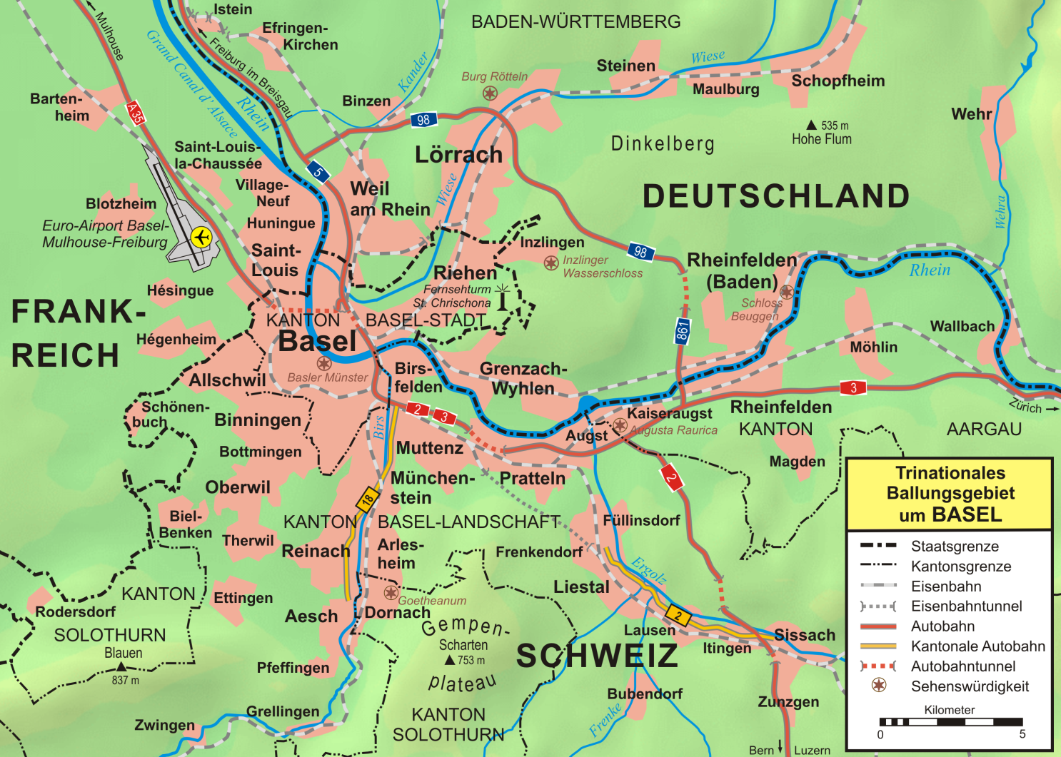
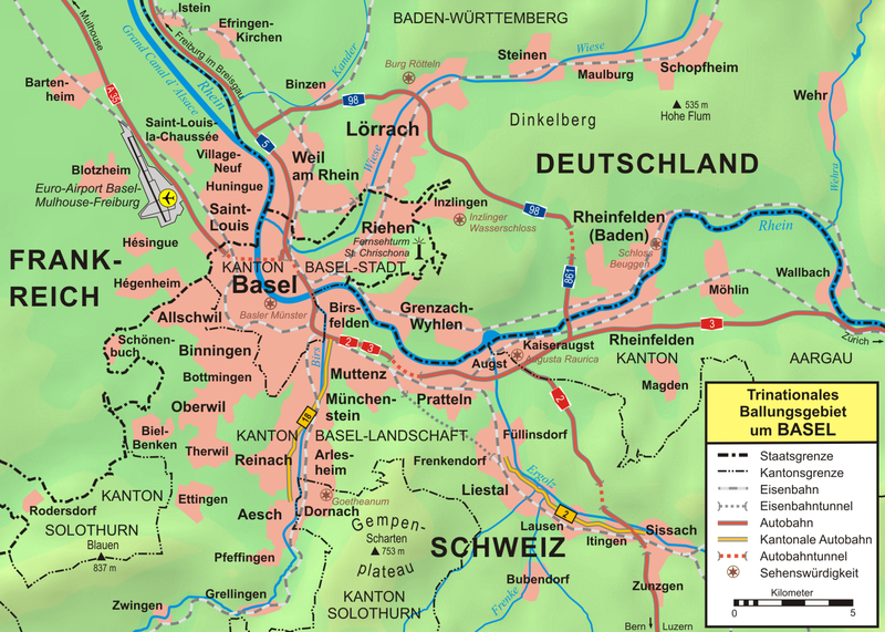
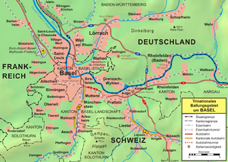
| Description | Topographische Karte vom Großraum Basel |
| Date | |
| Source |
own work, used:
|
| Author | first version by Wladyslaw Sojka, complete reworked version by Lencer |
| Other versions | SVG-Version |

|
This map has been made or improved in the German Kartenwerkstatt (Map Lab). You can propose maps to improve as well.
|
This file is licensed under the Creative Commons Attribution-Share Alike 3.0 Unported license.
- You are free:
- to share – to copy, distribute and transmit the work
- to remix – to adapt the work
- Under the following conditions:
- attribution – You must give appropriate credit, provide a link to the license, and indicate if changes were made. You may do so in any reasonable manner, but not in any way that suggests the licensor endorses you or your use.
- share alike – If you remix, transform, or build upon the material, you must distribute your contributions under the same or compatible license as the original.
File history
Click on a date/time to view the file as it appeared at that time.
| Date/Time | Thumbnail | Dimensions | User | Comment | |
|---|---|---|---|---|---|
| current | 15:34, 21 October 2012 | | 1,486 × 1,061 (1.28 MB) | Ras67 | cropped |
| 19:40, 19 October 2007 |  | 1,500 × 1,075 (1.29 MB) | Lencer | ||
| 16:16, 18 October 2007 |  | 1,500 × 1,075 (1.41 MB) | Lencer | ||
| 15:38, 18 October 2007 |  | 1,500 × 1,074 (1.41 MB) | Lencer | {{Information| |Description=Topographische Karte vom Großraum Basel |Source=own work, used: * [http://www.maps-for-free.com/ Google Maps-For-Free] SRTM3 Webserver * [http://www.openstreetmap.org/index.html OpenStreetMap] Webserver * [http: | |
| 16:59, 24 December 2006 |  | 2,068 × 1,422 (1.99 MB) | W-j-s | {{Information |Description=''no original description'' |Source=Originally from [http://de.wikipedia.org de.wikipedia]; description page is/was [http://de.wikipedia.org/w/index.php?title=Image%3AGrossraum_Basel.png here]. |Date=2006-09-04 (first version); |
File usage
The following page uses this file:
Global file usage
The following other wikis use this file:
- Usage on als.wikipedia.org
- Usage on azb.wikipedia.org
- Usage on be.wikipedia.org
- Usage on bg.wikipedia.org
- Usage on cs.wikipedia.org
- Usage on cv.wikipedia.org
- Usage on de.wikipedia.org
- Portal:Basel
- Wikipedia:Fotowerkstatt/Archiv 4
- Benutzer Diskussion:DemonDeLuxe
- Benutzer:Lencer
- Benutzer:Lencer/Galerie
- Benutzer:Mathetes/Portal Basel
- Benutzer:Walti us rieche/riehen
- Wikipedia:Kartenwerkstatt/Archiv/2007-10
- Wikipedia:Kandidaten für exzellente Bilder/Archiv2007/16
- Wikipedia:Kartenwerkstatt/Archiv/2008-03
- Benutzer:Lencer/Unterseite
- Wikipedia:Kandidaten für exzellente Bilder/Archiv2011/2
- Usage on en.wikipedia.org
- Usage on eo.wikipedia.org
- Usage on es.wikipedia.org
- Usage on eu.wikipedia.org
- Usage on fr.wikipedia.org
- Usage on hu.wikipedia.org
- Usage on hy.wikipedia.org
- Usage on it.wikipedia.org
- Usage on kk.wikipedia.org
- Usage on la.wikipedia.org
- Usage on nds.wikipedia.org
- Usage on nl.wikipedia.org
- Usage on no.wikipedia.org
- Usage on pl.wikipedia.org
View more global usage of this file.