
File:GuamMap.png

No higher resolution available.
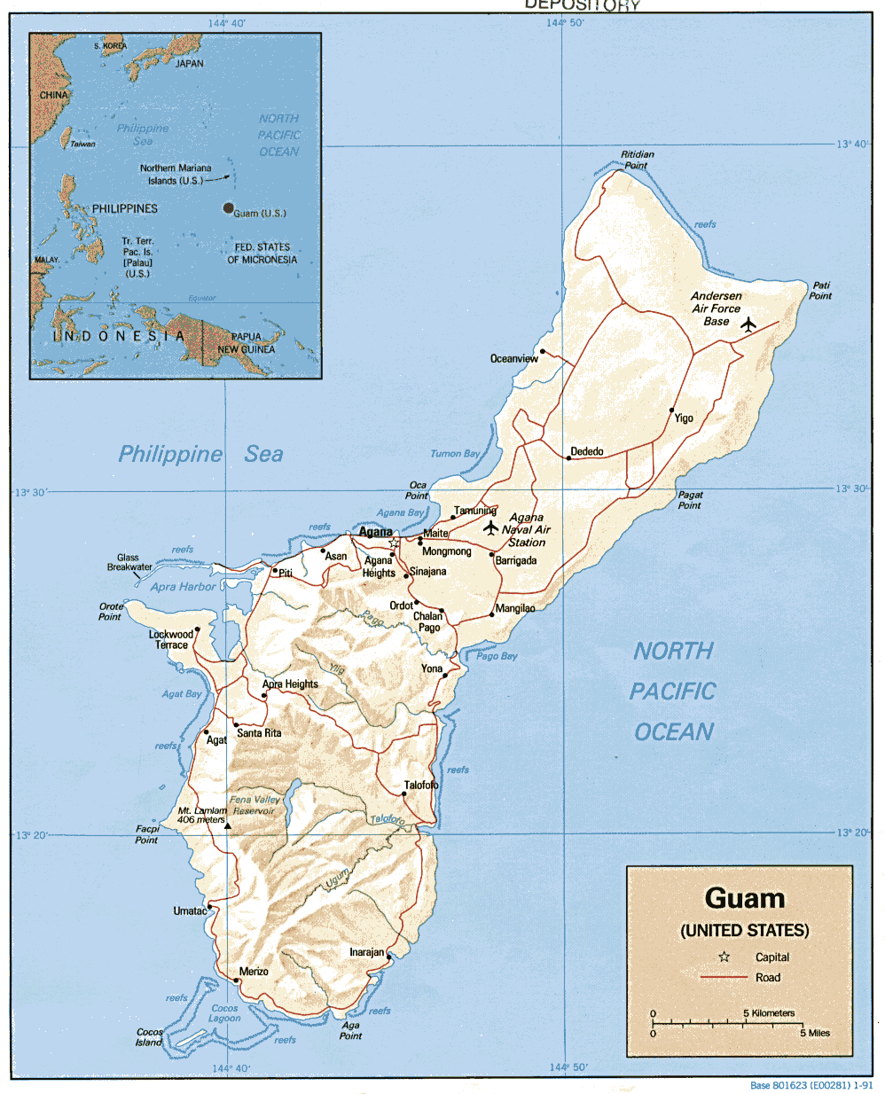
GuamMap.png (485 × 598 pixels, file size: 57 KB, MIME type: image/png)
| This is a file from the Wikimedia Commons. Information from its description page there is shown below. Commons is a freely licensed media file repository. You can help. |

|
This map image could be re-created using vector graphics as an SVG file. This has several advantages; see Commons:Media for cleanup for more information. If an SVG form of this image is available, please upload it and afterwards replace this template with
{{vector version available|new image name}}.
It is recommended to name the SVG file “GuamMap.svg”—then the template Vector version available (or Vva) does not need the new image name parameter. |
Summary
| Description |
English: Guam relief map; 'Guam map; modified from PCL map collection |
| Date | |
| Source | |
| Author | US Government (CIA) |
| Other versions |
 |
Licensing
| This image is a work of a Central Intelligence Agency employee, taken or made as part of that person's official duties. As a Work of the United States Government, this image or media is in the public domain in the United States.
|

|
File history
Click on a date/time to view the file as it appeared at that time.
| Date/Time | Thumbnail | Dimensions | User | Comment | |
|---|---|---|---|---|---|
| current | 21:08, 15 September 2006 | | 485 × 598 (57 KB) | Electionworld | 'Guam map; modified from [http://www.lib.utexas.edu/maps/index.html PCL map collection] {{PD-USGov-CIA}} Original source: U.S. Central Intelligence Agency 1991[http://www.lib.utexas.edu/maps/guam.html] |
File usage
The following page uses this file:
Global file usage
The following other wikis use this file:
- Usage on br.wikipedia.org
- Usage on bs.wikipedia.org
- Usage on ca.wikipedia.org
- Usage on en.wikipedia.org
- Usage on fa.wikipedia.org
- Usage on fr.wikipedia.org
- Usage on ga.wikipedia.org
- Usage on gl.wikipedia.org
- Usage on ha.wikipedia.org
- Usage on hif.wikipedia.org
- Usage on ht.wikipedia.org
- Usage on id.wikipedia.org
- Usage on it.wikipedia.org
- Usage on jv.wikipedia.org
- Usage on kn.wikipedia.org
- Usage on ko.wikipedia.org
- Usage on lb.wikipedia.org
- Usage on lrc.wikipedia.org
- Usage on lt.wikipedia.org
- Usage on ml.wikipedia.org
- Usage on ms.wikipedia.org
- Usage on mzn.wikipedia.org
- Usage on os.wikipedia.org
- Usage on sw.wikipedia.org
- Usage on ta.wikipedia.org
- Usage on tg.wikipedia.org
- Usage on tr.wiktionary.org
- Usage on uk.wikipedia.org
- Usage on www.wikidata.org