
File:KT boundary 054.jpg

Size of this preview: 800 × 600 pixels. Other resolutions: 320 × 240 pixels | 640 × 480 pixels | 1,024 × 768 pixels | 1,280 × 960 pixels | 1,600 × 1,200 pixels.
Original file (1,600 × 1,200 pixels, file size: 860 KB, MIME type: image/jpeg)
| This is a file from the Wikimedia Commons. Information from its description page there is shown below. Commons is a freely licensed media file repository. You can help. |
Summary
| Description |
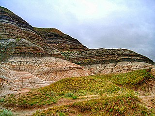
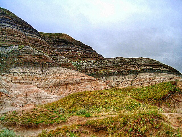
English: Badlands near Drumheller, Alberta, where erosion has exposed the K-Pg boundary. |
| Date | 12 August 2005 (original upload date) |
| Source | photo G Larson; Transferred from en.wikipedia |
| Author | Original uploader was Glenlarson at en.wikipedia |
| Permission (Reusing this file) |
PD-User |
Licensing
| |
This work has been released into the public domain by its author, Glenlarson, at the English Wikipedia project. This applies worldwide. In case this is not legally possible: |
Original upload log
The original description page was here. All following user names refer to en.wikipedia.
- 2005-08-12 20:57 Glenlarson 1600×1200×8 (769372 bytes) KT boundary photo G Larson {{pd}}
File history
Click on a date/time to view the file as it appeared at that time.
| Date/Time | Thumbnail | Dimensions | User | Comment | |
|---|---|---|---|---|---|
| current | 12:23, 12 April 2022 | | 1,600 × 1,200 (860 KB) | J. N. Squire | Colors, contrast and saturation adjusted |
| 18:18, 19 January 2008 |  | 1,600 × 1,200 (751 KB) | EuTuga | {{Information |Description={{en|Badlands near Drumheller, Alberta, where erosion has exposed the KT boundary.}} |Source=photo G Larson; Transferred from [http://en.wikipedia.org en.wikipedia] |Date=2005-08-12 (original upload date) |
File usage
The following page uses this file:
Global file usage
The following other wikis use this file:
- Usage on af.wikipedia.org
- Usage on ar.wikipedia.org
- Usage on bs.wikipedia.org
- Usage on ca.wikipedia.org
- Usage on cs.wikipedia.org
- Usage on da.wikipedia.org
- Usage on de.wikipedia.org
- Usage on el.wikipedia.org
- Usage on en.wikipedia.org
- Usage on en.wikibooks.org
- Usage on en.wikiversity.org
- Usage on eo.wikipedia.org
- Usage on es.wikipedia.org
- Usage on fa.wikipedia.org
- Usage on fr.wikipedia.org
- Usage on gl.wikipedia.org
- Usage on he.wikipedia.org
- Usage on hu.wikipedia.org
- Usage on id.wikipedia.org
- Usage on it.wikipedia.org
- Usage on ja.wikipedia.org
- Usage on kw.wikipedia.org
- Usage on la.wikipedia.org
- Usage on mk.wikipedia.org
- Usage on ml.wikipedia.org
- Usage on ms.wikipedia.org
- Usage on nn.wikipedia.org
- Usage on no.wikipedia.org
- Usage on oc.wikipedia.org
- Usage on pl.wikipedia.org
- Usage on pt.wikipedia.org
- Usage on ro.wikipedia.org
- Usage on ru.wikipedia.org
View more global usage of this file.