
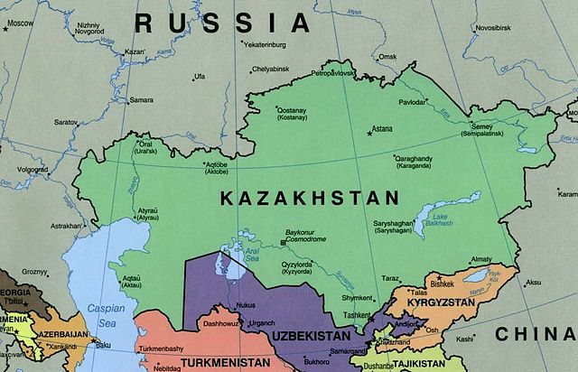
File:Kazakhstan political map 2000.jpg

Size of this preview: 800 × 515 pixels. Other resolutions: 320 × 206 pixels | 640 × 412 pixels | 1,074 × 691 pixels.
Original file (1,074 × 691 pixels, file size: 384 KB, MIME type: image/jpeg)
| This is a file from the Wikimedia Commons. Information from its description page there is shown below. Commons is a freely licensed media file repository. You can help. |
Summary
| Description |
English: Kazakhstan Political Map 2000 |
| Date | |
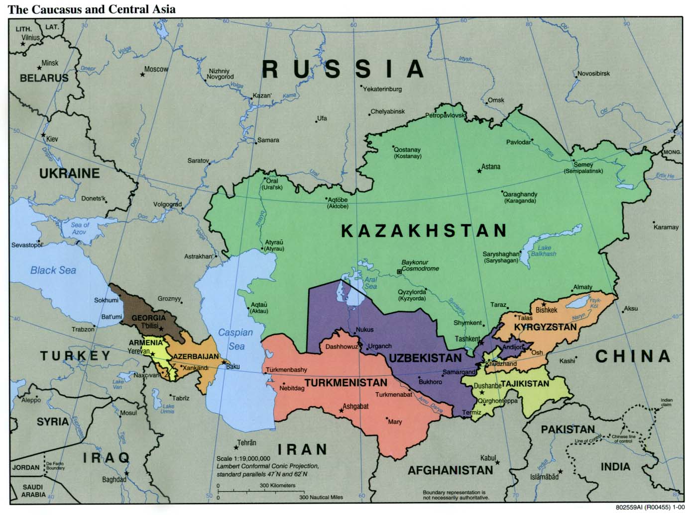
| Source | University of Texas Libraries, Perry-Castañeda Library Map Collection: Kazakhstan maps. Extracted from "The Caucasus and Central Asia Political Map 2000" |
| Author | U.S. Central Intelligence Agency |
Licensing
| This image is a work of a Central Intelligence Agency employee, taken or made as part of that person's official duties. As a Work of the United States Government, this image or media is in the public domain in the United States.
|

|
File history
Click on a date/time to view the file as it appeared at that time.
| Date/Time | Thumbnail | Dimensions | User | Comment | |
|---|---|---|---|---|---|
| current | 01:52, 9 November 2004 | | 1,074 × 691 (384 KB) | Annalog~commonswiki | resized image |
| 01:45, 9 November 2004 |  | 1,103 × 664 (480 KB) | Annalog~commonswiki | Kazakhstan Political Map 2000 |
File usage
The following page uses this file:
Global file usage
The following other wikis use this file:
- Usage on ckb.wikipedia.org
- Usage on de.wikibooks.org
- Usage on en.wikipedia.org
- Usage on fa.wikipedia.org
- Usage on fi.wikipedia.org
- Usage on gag.wikipedia.org
- Usage on glk.wikipedia.org
- Usage on gl.wikipedia.org
- Usage on he.wikipedia.org
- Usage on hif.wikipedia.org
- Usage on is.wikibooks.org
- Usage on kk.wikipedia.org
- Usage on pl.wikipedia.org
- Usage on pl.wikinews.org
- Usage on sv.wikinews.org
- Usage on sw.wikipedia.org
- Usage on ta.wikinews.org
- Usage on th.wikipedia.org
- Usage on uz.wikipedia.org