
File:Kurdistan project en 2.PNG
Size of this preview: 800 × 576 pixels. Other resolutions: 320 × 230 pixels | 640 × 461 pixels | 1,024 × 737 pixels | 1,417 × 1,020 pixels.
Original file (1,417 × 1,020 pixels, file size: 424 KB, MIME type: image/png)
| This is a file from the Wikimedia Commons. Information from its description page there is shown below. Commons is a freely licensed media file repository. You can help. |
Summary
| Description |
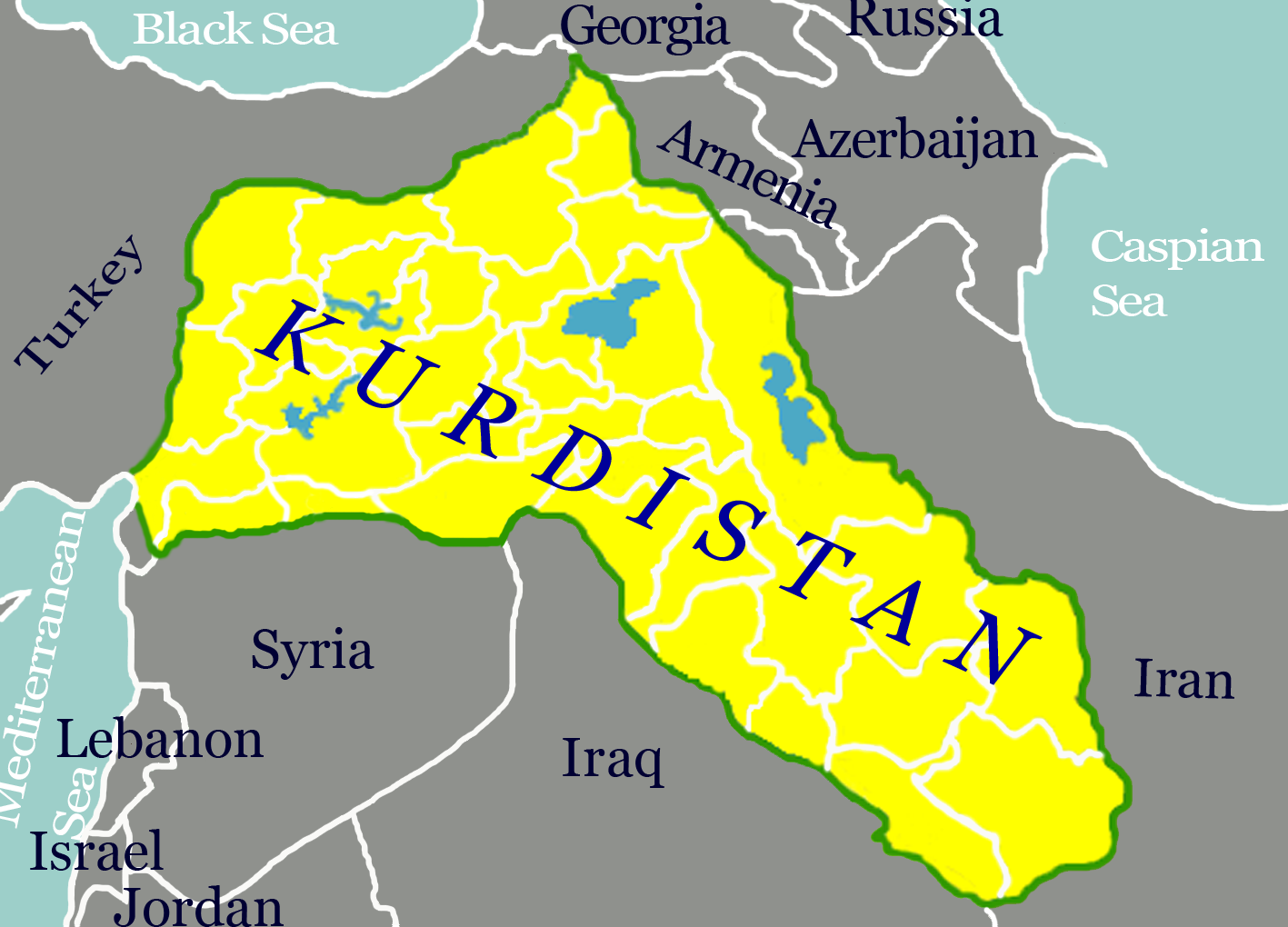
English: "Kurdistan" means "the land of Kurds". Originally this designated a region of Western Iran. This map extends the concept to cover the greater region with any significant Kurdish population and encompases parts of the territories of Iran, Iraq, Syria, and Turkey. |
| Date | |
| Source | Own work |
| Author | Ferhates |
Licensing
I, the copyright holder of this work, hereby publish it under the following license:
This file is licensed under the Creative Commons Attribution-Share Alike 3.0 Unported license.
- You are free:
- to share – to copy, distribute and transmit the work
- to remix – to adapt the work
- Under the following conditions:
- attribution – You must give appropriate credit, provide a link to the license, and indicate if changes were made. You may do so in any reasonable manner, but not in any way that suggests the licensor endorses you or your use.
- share alike – If you remix, transform, or build upon the material, you must distribute your contributions under the same or compatible license as the original.
File history
Click on a date/time to view the file as it appeared at that time.
| Date/Time | Thumbnail | Dimensions | User | Comment | |
|---|---|---|---|---|---|
| current | 10:03, 10 December 2013 | | 1,417 × 1,020 (424 KB) | Ferhates | User created page with UploadWizard |
File usage
The following page uses this file: