
File:Lage der kreisfreien Stadt Lübeck in Deutschland.png
No higher resolution available.
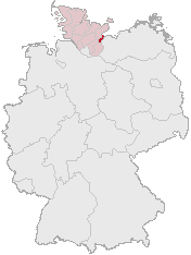
Lage_der_kreisfreien_Stadt_Lübeck_in_Deutschland.png (176 × 234 pixels, file size: 4 KB, MIME type: image/png)
| This is a file from the Wikimedia Commons. Information from its description page there is shown below. Commons is a freely licensed media file repository. You can help. |
Summary
Karte erstellt auf der Grundlage der opengeodb.de-Umrisse - GNU-FDL
Geograv 00:52, 31. Dez 2004
Licensing
This image was generated with OpenGeoDB. The information there is placed in the public domain, images generated from OpenGeoDB are derivative works without passing the threshold of creativity, they are therefore also public domain.
| This work is ineligible for copyright and therefore in the public domain because it consists entirely of information that is common property and contains no original authorship. |
File history
Click on a date/time to view the file as it appeared at that time.
| Date/Time | Thumbnail | Dimensions | User | Comment | |
|---|---|---|---|---|---|
| current | 13:22, 15 February 2007 | | 176 × 234 (4 KB) | Ditschi | nochmal |
| 13:17, 15 February 2007 |  | 176 × 234 (4 KB) | Ditschi | transparent | |
| 05:41, 11 April 2006 |  | 176 × 234 (4 KB) | Jed | Reverted to earlier revision | |
| 13:16, 26 March 2006 |  | 188 × 235 (3 KB) | Jed | ||
| 00:17, 8 March 2006 |  | 176 × 234 (4 KB) | Rauenstein | Karte erstellt auf der Grundlage der opengeodb.de-Umrisse - GNU-FDL Geograv 00:52, 31. Dez 2004 {{Bild-GFDL}} Category:Location maps of Schleswig-Holstein |
File usage
There are no pages that use this file.
Global file usage
The following other wikis use this file:
- Usage on af.wikipedia.org
- Usage on azb.wikipedia.org
- Usage on da.wikipedia.org
- Usage on eo.wikipedia.org
- Usage on et.wikipedia.org
- Usage on id.wikipedia.org
- Usage on io.wikipedia.org
- Usage on is.wikipedia.org
- Usage on jv.wikipedia.org
- Usage on ko.wikibooks.org
- Usage on nds-nl.wikipedia.org
- Usage on oc.wikipedia.org
- Usage on pms.wikipedia.org
- Usage on pnb.wikipedia.org
- Usage on ro.wikipedia.org
- Usage on sv.wikipedia.org
- Usage on vls.wikipedia.org
- Usage on zh-min-nan.wikipedia.org