
File:Lake biwa.jpg
Size of this preview: 439 × 600 pixels. Other resolutions: 176 × 240 pixels | 351 × 480 pixels | 562 × 768 pixels | 1,024 × 1,399 pixels.
Original file (1,024 × 1,399 pixels, file size: 176 KB, MIME type: image/jpeg)
| This is a file from the Wikimedia Commons. Information from its description page there is shown below. Commons is a freely licensed media file repository. You can help. |
Summary
| Description |
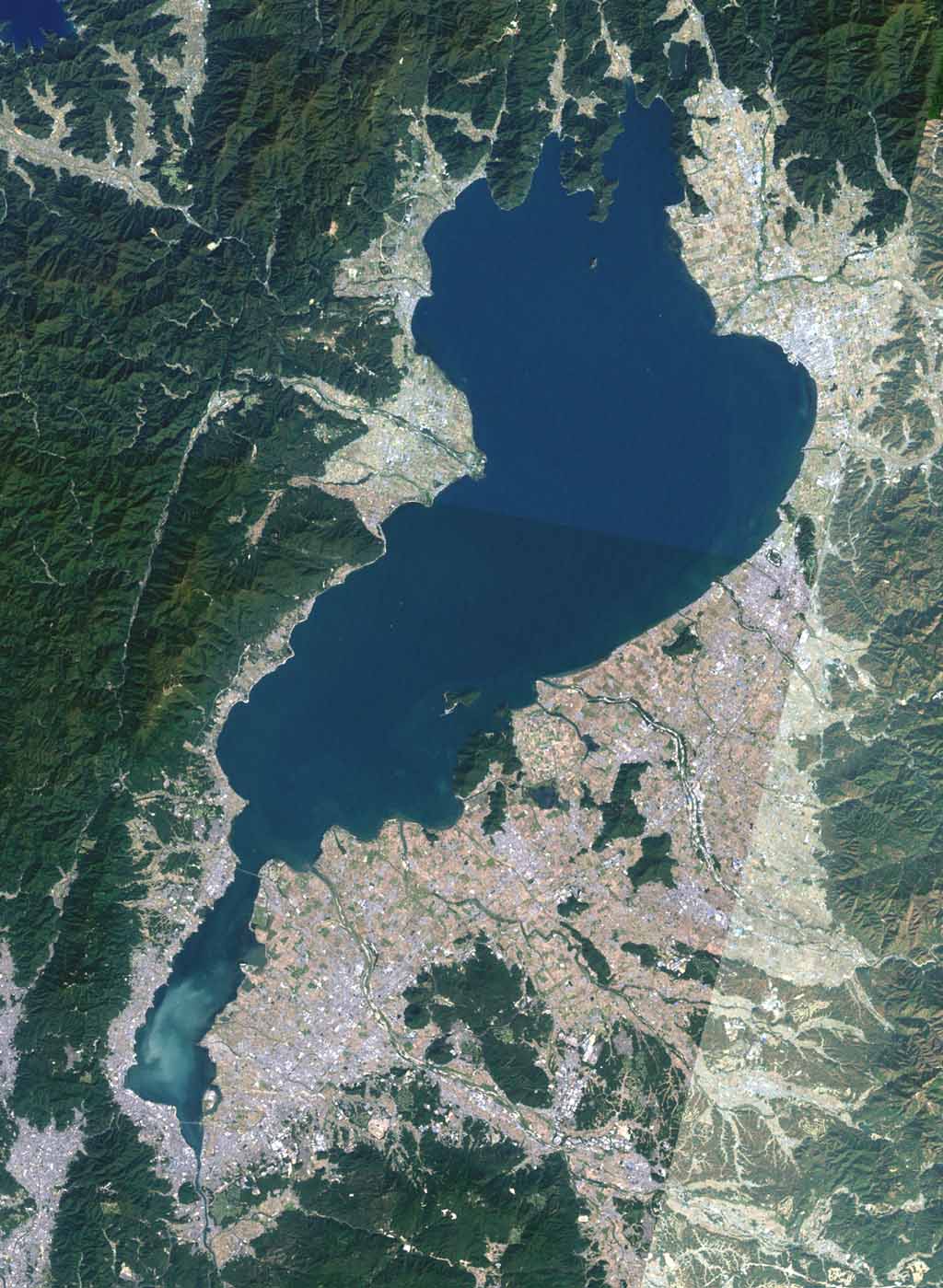
日本語: 琵琶湖のランドサット画像。画面下側の細い部分が「南湖」、その上に大きく広がっているのが「北湖」と呼ばれる水域。投稿者作成(下記参照)。
English: Landsat image of Lake Biwa. The narrow part at the bottom of the image is called "South Lake", and the large area above is called "North Lake". |
||
| Source | The Landsat satellite pictures are used for this image. The data came from Global Land Cover Facility (GLCF), and are processed with Kashmir 3D. | ||
| Author | Global Land Cover Facility (GLCF) | ||
| Permission (Reusing this file) |
|
Licensing
| This file is licensed under the Creative Commons Attribution-Share Alike 3.0 Unported license. Subject to disclaimers. | ||
| ||
| This licensing tag was added to this file as part of the GFDL licensing update. |

|
Permission is granted to copy, distribute and/or modify this document under the terms of the GNU Free Documentation License, Version 1.2 or any later version published by the Free Software Foundation; with no Invariant Sections, no Front-Cover Texts, and no Back-Cover Texts. A copy of the license is included in the section entitled GNU Free Documentation License. Subject to disclaimers. |
Original upload log
| This file was moved from Japanese Wikipedia.
See below for original file information. | ||||||||||||||||||||||||||||||||
| ||||||||||||||||||||||||||||||||
|
| ||||||||||||||||||||||||||||||||
File history
Click on a date/time to view the file as it appeared at that time.
| Date/Time | Thumbnail | Dimensions | User | Comment | |
|---|---|---|---|---|---|
| current | 14:16, 10 March 2006 | | 1,024 × 1,399 (176 KB) | Moja~commonswiki | Lake Biwa in Japan. The image is taken from ja:画像:Lake biwa.jpg. |
| 13:59, 16 December 2005 |  | 1,024 × 1,399 (176 KB) | Tdk | 琵琶湖のランドサット画像。画面下側の細い部分が「南湖」、その上に大きく広がっているのが「北湖」と呼ばれる水域。{{landsat}} |
File usage
The following page uses this file:
Global file usage
The following other wikis use this file:
- Usage on ar.wikipedia.org
- Usage on arz.wikipedia.org
- Usage on ban.wikipedia.org
- Usage on bat-smg.wikipedia.org
- Usage on bcl.wikipedia.org
- Usage on be-tarask.wikipedia.org
- Usage on be.wikipedia.org
- Usage on bg.wikipedia.org
- Usage on bs.wikipedia.org
- Usage on ca.wikipedia.org
- Usage on ceb.wikipedia.org
- Usage on cs.wikipedia.org
- Usage on cv.wikipedia.org
- Usage on de.wikipedia.org
- Usage on el.wikipedia.org
- Usage on en.wikipedia.org
- Usage on en.wikivoyage.org
- Usage on es.wikipedia.org
- Usage on eu.wikipedia.org
- Usage on fa.wikipedia.org
- Usage on fr.wikipedia.org
- Usage on fr.wikivoyage.org
- Usage on he.wikipedia.org
- Usage on he.wikivoyage.org
- Usage on hr.wikipedia.org
- Usage on hu.wikipedia.org
- Usage on hy.wikipedia.org
- Usage on id.wikipedia.org
- Usage on incubator.wikimedia.org
- Usage on it.wikipedia.org
- Usage on ja.wikipedia.org
View more global usage of this file.