
File:Les Francs entre 400 et 440.svg

Size of this PNG preview of this SVG file: 800 × 595 pixels. Other resolutions: 320 × 238 pixels | 640 × 476 pixels | 1,024 × 762 pixels | 1,280 × 953 pixels | 2,560 × 1,905 pixels | 2,323 × 1,729 pixels.
Original file (SVG file, nominally 2,323 × 1,729 pixels, file size: 430 KB)
| This is a file from the Wikimedia Commons. Information from its description page there is shown below. Commons is a freely licensed media file repository. You can help. |
Summary
| Description |
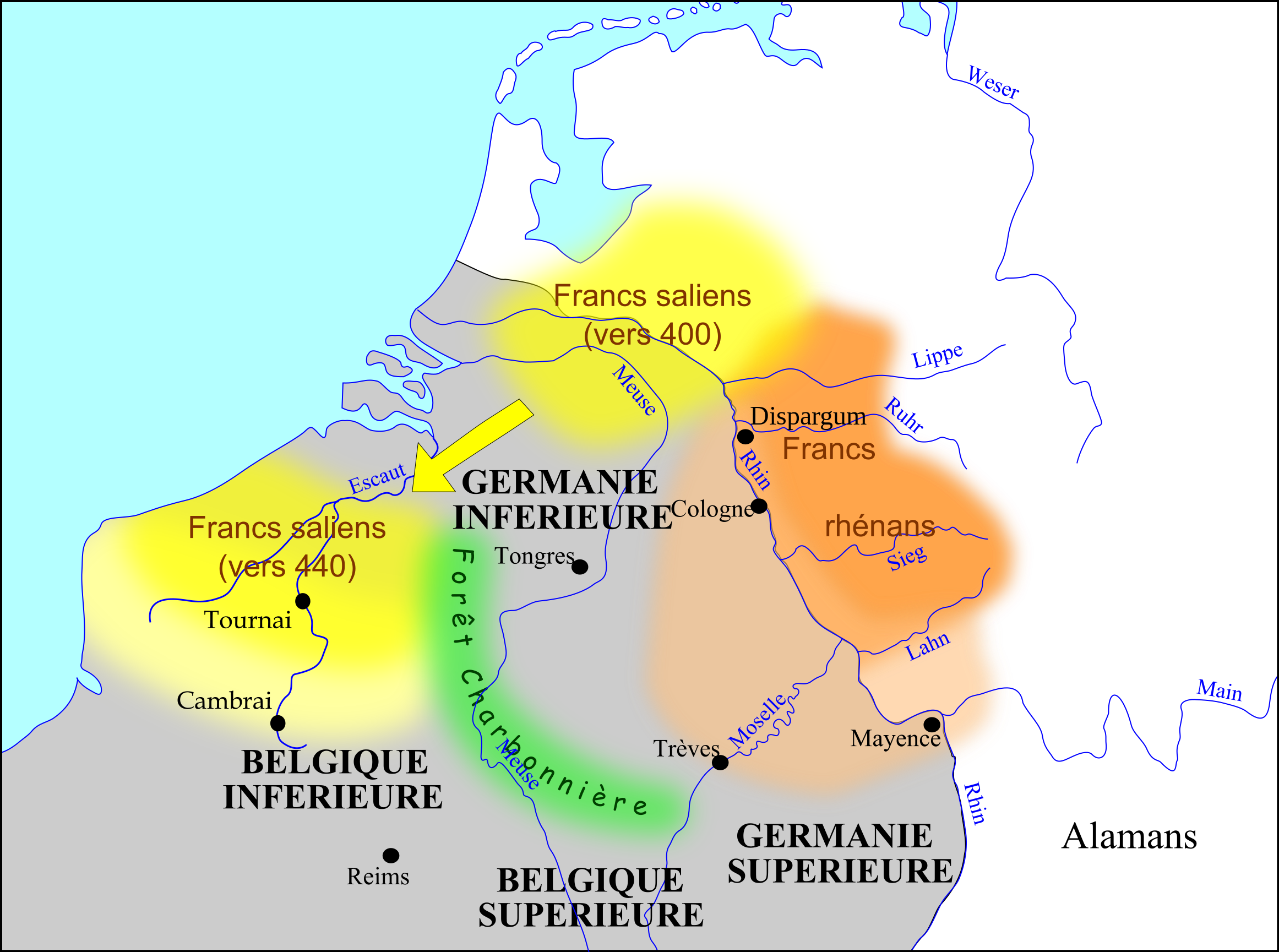
Français : Carte des Francs entre 400 et 440. |
||||
| Date | |||||
| Source |
Own work
Extension des frontières franques d'après :
|
||||
| Author | Odejea | ||||
| Other versions | Dutch translation: File:De Franken tussen 400 en 440 nl.svg |

.svg)
Licensing
I, the copyright holder of this work, hereby publish it under the following licenses:

|
Permission is granted to copy, distribute and/or modify this document under the terms of the GNU Free Documentation License, Version 1.2 or any later version published by the Free Software Foundation; with no Invariant Sections, no Front-Cover Texts, and no Back-Cover Texts. A copy of the license is included in the section entitled GNU Free Documentation License. |
This file is licensed under the Creative Commons Attribution-Share Alike 3.0 Unported, 2.5 Generic, 2.0 Generic and 1.0 Generic license.
- You are free:
- to share – to copy, distribute and transmit the work
- to remix – to adapt the work
- Under the following conditions:
- attribution – You must give appropriate credit, provide a link to the license, and indicate if changes were made. You may do so in any reasonable manner, but not in any way that suggests the licensor endorses you or your use.
- share alike – If you remix, transform, or build upon the material, you must distribute your contributions under the same or compatible license as the original.
You may select the license of your choice.
File history
Click on a date/time to view the file as it appeared at that time.
| Date/Time | Thumbnail | Dimensions | User | Comment | |
|---|---|---|---|---|---|
| current | 14:02, 16 April 2017 | | 2,323 × 1,729 (430 KB) | Spazzo | Dispargum added. |
| 13:58, 16 April 2017 |  | 2,323 × 1,729 (428 KB) | Spazzo | Reverted to version as of 14:26, 15 November 2009 (UTC) | |
| 13:57, 16 April 2017 |  | 2,323 × 1,729 (430 KB) | Spazzo | Dispargum added | |
| 14:26, 15 November 2009 |  | 2,323 × 1,729 (428 KB) | Odejea | (Frontière des Francs Saliens avant 400 : Ils occupaient également la Toxandrie dans l'Empire romain) | |
| 14:22, 15 November 2009 |  | 2,323 × 1,729 (428 KB) | Odejea | Frontière des Francs Saliens avant 400 : Ils occupaient également la Toxandrie dans l'Empire romain | |
| 13:17, 14 November 2009 |  | 2,323 × 1,729 (428 KB) | Odejea | {{Information |Description={{fr|1=Carte des Francs entre 400 et 440.}} |Source={{own}} |Author=Odejea |Date=14 novembre 2009 |Permission= |other_versions= }} Category:Maps showing history of the Early Middle Ages [[Category:Maps of th |
File usage
The following page uses this file:
Global file usage
The following other wikis use this file:
- Usage on be.wikipedia.org
- Usage on bg.wikipedia.org
- Usage on de.wikipedia.org
- Usage on en.wikipedia.org
- Usage on fr.wikipedia.org
- Clovis Ier
- Francs
- Liste des rois des Francs saliens
- Francs rhénans
- Histoire du Nord-Pas-de-Calais
- Francs saliens
- Histoire de la Wallonie
- Histoire de la Normandie
- Forêt Charbonnière
- Discussion utilisateur:Le scripteur
- Discussion utilisateur:Odejea/2009/04
- Histoire de la Flandre
- Royaumes francs
- Flandre (terminologie)
- Drapeau du Nord-Pas-de-Calais
- Ve siècle en Lorraine
- Utilisateur:Hippo75/Infobox France
- Usage on fr.wiktionary.org
- Usage on fy.wikipedia.org
- Usage on hu.wikipedia.org
- Usage on id.wikipedia.org
- Usage on it.wikipedia.org
- Usage on ku.wikipedia.org
- Usage on la.wikipedia.org
- Usage on mk.wikipedia.org
- Usage on pl.wikipedia.org
- Usage on sl.wikipedia.org
- Usage on uk.wikipedia.org