
File:Lublin Voivodeship administrative.png

Size of this preview: 397 × 600 pixels. Other resolutions: 159 × 240 pixels | 318 × 480 pixels | 508 × 768 pixels | 1,069 × 1,615 pixels.
Original file (1,069 × 1,615 pixels, file size: 336 KB, MIME type: image/png)
| This is a file from the Wikimedia Commons. Information from its description page there is shown below. Commons is a freely licensed media file repository. You can help. |
Summary
| Description |
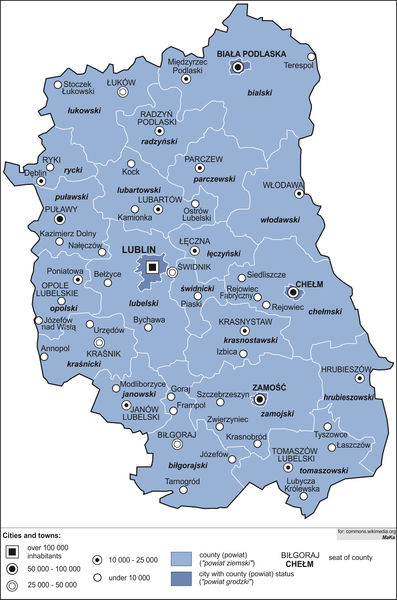
English: Administrative map of Lublin Voivodeship
Polski: Mapa administracyjna województwa lubelskiego |
| Date | |
| Source | Own work (own work by uploader) |
| Author | MaKa~commonswiki |
| Other versions |
|

Licensing
I, the copyright holder of this work, hereby publish it under the following licenses:

|
Permission is granted to copy, distribute and/or modify this document under the terms of the GNU Free Documentation License, Version 1.2 or any later version published by the Free Software Foundation; with no Invariant Sections, no Front-Cover Texts, and no Back-Cover Texts. A copy of the license is included in the section entitled GNU Free Documentation License. |
This file is licensed under the Creative Commons Attribution-Share Alike 4.0 International, 3.0 Unported, 2.5 Generic, 2.0 Generic and 1.0 Generic license.
- You are free:
- to share – to copy, distribute and transmit the work
- to remix – to adapt the work
- Under the following conditions:
- attribution – You must give appropriate credit, provide a link to the license, and indicate if changes were made. You may do so in any reasonable manner, but not in any way that suggests the licensor endorses you or your use.
- share alike – If you remix, transform, or build upon the material, you must distribute your contributions under the same or compatible license as the original.
You may select the license of your choice.
File history
Click on a date/time to view the file as it appeared at that time.
| Date/Time | Thumbnail | Dimensions | User | Comment | |
|---|---|---|---|---|---|
| current | 17:16, 3 January 2022 | | 1,069 × 1,615 (336 KB) | MaKa~commonswiki | + Izbica town |
| 16:46, 2 January 2021 |  | 1,069 × 1,615 (335 KB) | MaKa~commonswiki | + 2 new towns: Goraj, Kamionka | |
| 19:44, 2 January 2018 |  | 1,069 × 1,615 (332 KB) | MaKa~commonswiki | + Józefów nad Wisłą town (2018) | |
| 08:53, 22 December 2016 |  | 1,069 × 1,615 (330 KB) | MaKa~commonswiki | + Rejowiec town (2017) | |
| 07:50, 31 December 2015 |  | 1,069 × 1,615 (329 KB) | MaKa~commonswiki | + 3 new towns | |
| 10:23, 27 December 2013 |  | 1,069 × 1,615 (322 KB) | MaKa~commonswiki | + Modliborzyce town (2014) | |
| 19:47, 27 September 2012 |  | 1,068 × 1,614 (299 KB) | MaKa~commonswiki | descript in key (legend): count, city count | |
| 15:07, 6 January 2010 |  | 1,068 × 1,614 (241 KB) | MaKa~commonswiki | == {{int:filedesc}} == {{Information |Description={{en|1=Administrative map of Lublin Voivodeship}} {{pl|1=Mapa administracyjna województwa lubelskiego}} |Source={{own}}(own work by uploader) |Author=MaKa |Date=2008-12 |Permission= |other_v | |
| 20:18, 4 December 2008 |  | 1,068 × 1,614 (252 KB) | MaKa~commonswiki | {{Information |Description={{en|1=Administrative map of Lublin Voivodeship}} {{pl|1=Mapa administracyjna województwa lubelskiego}} |Source=Praca własna osoby przesyłającej (own work by uploader) |Author=MaKa |Date=2008-12 |Permission= |o |
File usage
The following page uses this file:
Global file usage
The following other wikis use this file:
- Usage on ar.wikipedia.org
- Usage on da.wikipedia.org
- Usage on en.wikipedia.org
- Usage on fa.wikipedia.org
- Usage on id.wikipedia.org
- Usage on pl.wikipedia.org
- Usage on ps.wikipedia.org
- Usage on ur.wikipedia.org
- Usage on yi.wikipedia.org