
File:Map Gotthard-Basistunnel.png
Size of this preview: 465 × 599 pixels. Other resolutions: 186 × 240 pixels | 372 × 480 pixels | 596 × 768 pixels | 794 × 1,024 pixels | 2,535 × 3,268 pixels.
Original file (2,535 × 3,268 pixels, file size: 7.64 MB, MIME type: image/png)
| This is a file from the Wikimedia Commons. Information from its description page there is shown below. Commons is a freely licensed media file repository. You can help. |
Summary
| Description |
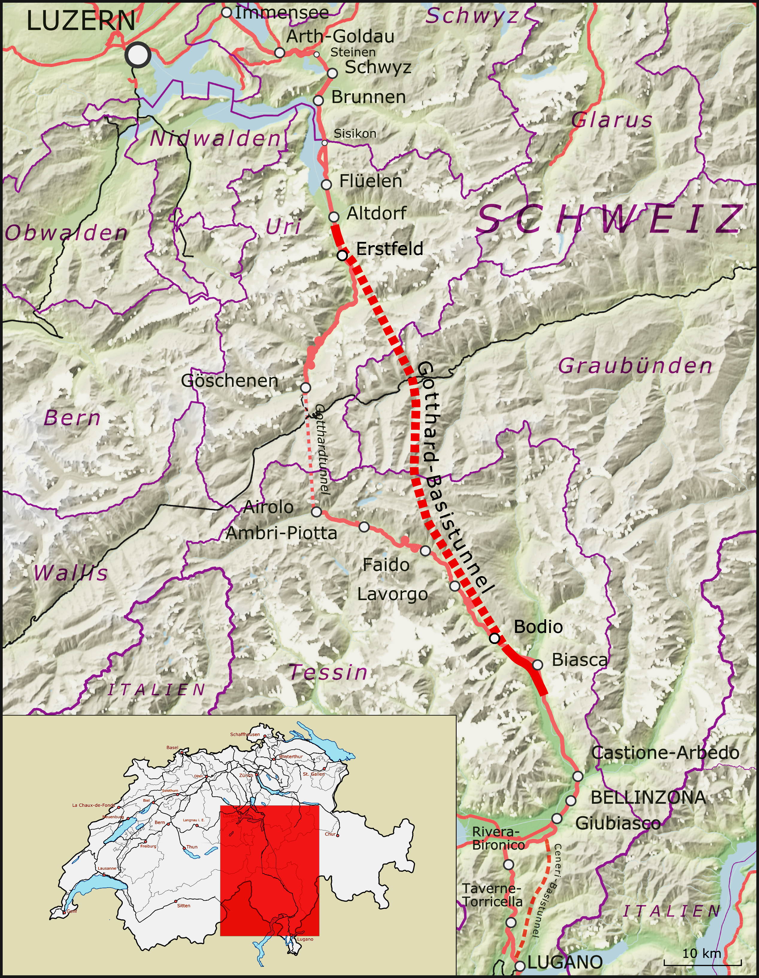
Deutsch: Karte des Gotthard-Basistunnels, Schweiz
Alemannisch: Charte vom Gotthard-Basistunnel, Schwiz
Français : Carte de la tunnel de base du Saint-Gothard, Suisse
Italiano: Mappa della galleria di base del San Gottardo, Svizzera
Nederlands: Kaart van de Gotthard-basistunnel, Zwitserland
Rumantsch: Charta dal tunnel da basa dal Son Gottard, Svizra |
|||||||||
| Date | ||||||||||
| Source |
Map was created using:
|
|||||||||
| Creator |
|
|||||||||
| Permission (Reusing this file) |
Map data (c) OpenStreetMap (and) contributors, CC-BY-SA | |||||||||
| Geotemporal data | ||||||||||
| Bounding box |
|
|||||||||
| Georeferencing | ||||||||||
| Other versions |
|
|||||||||


Licensing
This file is licensed under the Creative Commons Attribution-Share Alike 2.0 Generic license.
- You are free:
- to share – to copy, distribute and transmit the work
- to remix – to adapt the work
- Under the following conditions:
- attribution – You must give appropriate credit, provide a link to the license, and indicate if changes were made. You may do so in any reasonable manner, but not in any way that suggests the licensor endorses you or your use.
- share alike – If you remix, transform, or build upon the material, you must distribute your contributions under the same or compatible license as the original.
| This work is licensed under the Open Database License (summary). |
File history
Click on a date/time to view the file as it appeared at that time.
| Date/Time | Thumbnail | Dimensions | User | Comment | |
|---|---|---|---|---|---|
| current | 10:22, 1 January 2017 | | 2,535 × 3,268 (7.64 MB) | Antonsusi | try it again |
| 10:20, 1 January 2017 |  | 2,535 × 3,268 (7.32 MB) | Antonsusi | Adjusting brightness | |
| 11:26, 26 December 2016 |  | 2,535 × 3,268 (7.32 MB) | Pechristener | location map larger and updated to the 2016 version showing the GBT | |
| 11:07, 26 December 2016 |  | 2,535 × 3,268 (7.77 MB) | Pechristener | original map adapted to the new desired format, red border of location map removed, strange border color replaced and scale added | |
| 15:12, 19 December 2016 |  | 2,500 × 3,250 (8.16 MB) | Antonsusi | adjusting rect | |
| 16:56, 1 November 2016 |  | 2,500 × 3,250 (8.17 MB) | Antonsusi | Adjusting red square | |
| 11:28, 1 November 2016 |  | 2,500 × 3,250 (6.57 MB) | Antonsusi | Less upright size makes the use easier. Therefore: Environment of low interest cropped. Small map moved to the edge of low interest. | |
| 07:24, 15 October 2016 |  | 2,702 × 6,264 (12.61 MB) | Pechristener | very small correction in the North East Corenr of the base map | |
| 07:03, 15 October 2016 |  | 2,702 × 6,264 (12.61 MB) | Pechristener | == {{int:filedesc}} == {{Map |Description = {{de|1=Karte des Gotthard-Basistunnels in der Schweiz}} {{als|1=Charte vom Gotthard-Basistunnel}} {{fr|1=Carte de la [[:fr:Tunnel de base du Saint... |
File usage
The following page uses this file:
Global file usage
The following other wikis use this file:
- Usage on bg.wikipedia.org
- Usage on bn.wikipedia.org
- Usage on ca.wikipedia.org
- Usage on cy.wikipedia.org
- Usage on de.wikipedia.org
- Usage on en.wikipedia.org
- Usage on es.wikipedia.org
- Usage on et.wikipedia.org
- Usage on fi.wikipedia.org
- Usage on fr.wikipedia.org
- Usage on it.wikipedia.org
- Usage on ja.wikipedia.org
- Usage on nl.wikipedia.org
- Usage on nn.wikipedia.org
- Usage on sr.wikipedia.org
- Usage on sv.wikipedia.org
- Usage on tr.wikipedia.org
- Usage on vi.wikipedia.org
- Usage on www.wikidata.org
- Usage on zh-yue.wikipedia.org