
File:Map Mondercange.PNG
No higher resolution available.
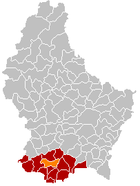
Map_Mondercange.PNG (203 × 270 pixels, file size: 7 KB, MIME type: image/png)
| This is a file from the Wikimedia Commons. Information from its description page there is shown below. Commons is a freely licensed media file repository. You can help. |
English: Own edit of Kanton Esch-sur-AlzetteLocatie.png
| I, the copyright holder of this work, release this work into the public domain. This applies worldwide. In some countries this may not be legally possible; if so: I grant anyone the right to use this work for any purpose, without any conditions, unless such conditions are required by law. |
File history
Click on a date/time to view the file as it appeared at that time.
| Date/Time | Thumbnail | Dimensions | User | Comment | |
|---|---|---|---|---|---|
| current | 18:55, 9 January 2018 | | 203 × 270 (7 KB) | NordNordWest | upd |
| 21:14, 10 November 2015 |  | 203 × 270 (6 KB) | NordNordWest | no more districts in Luxembourg | |
| 21:30, 21 October 2005 |  | 203 × 270 (4 KB) | Markussep | own edit of Image:Kanton Esch-sur-AlzetteLocatie.png Category:Maps of municipalities of Luxembourg |
File usage
The following page uses this file:
Global file usage
The following other wikis use this file:
- Usage on als.wikipedia.org
- Usage on be-tarask.wikipedia.org
- Usage on be.wikipedia.org
- Usage on ca.wikipedia.org
- Usage on da.wikipedia.org
- Usage on de.wikipedia.org
- Usage on fa.wikipedia.org
- Usage on it.wikipedia.org
- Usage on lb.wikipedia.org
- Usage on nl.wikipedia.org
- Usage on no.wikipedia.org
- Usage on pl.wikipedia.org
- Usage on pt.wikipedia.org
- Usage on ro.wikipedia.org
- Usage on ru.wikipedia.org
- Usage on sk.wikipedia.org
- Usage on sv.wikipedia.org
- Usage on tr.wikipedia.org
- Usage on uk.wikipedia.org
- Usage on www.wikidata.org
- Usage on zh-min-nan.wikipedia.org
- Usage on zh.wikipedia.org