
File:Map of Boston and Cambridge.png

Size of this preview: 800 × 600 pixels. Other resolutions: 320 × 240 pixels | 640 × 480 pixels | 1,024 × 768 pixels | 1,280 × 960 pixels | 1,600 × 1,200 pixels.
Original file (1,600 × 1,200 pixels, file size: 1.98 MB, MIME type: image/png)
| This is a file from the Wikimedia Commons. Information from its description page there is shown below. Commons is a freely licensed media file repository. You can help. |
Summary
| Description |
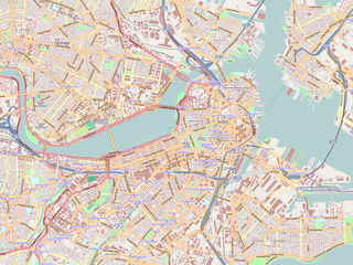
English: Map of the central area of Boston and Cambridge, exported from OpenStreetMap.
日本語: ボストン中心部及びケンブリッジの地図。オープン・ストリート・マップから作成。 |
||||||||||||
| Date | |||||||||||||
| Source | http://openstreetmap.org/ | ||||||||||||
| Author | OpenStreetMap contributors | ||||||||||||
| Permission (Reusing this file) |
|

|
This complex map image could be re-created using vector graphics as an SVG file. This has several advantages; see Commons:Media for cleanup for more information. If an SVG form of this image is available, please upload it and afterwards replace this template with
{{vector version available|new image name}}.Note: Existing vector data is available from osmwiki:SVG. It is recommended to name the SVG file “Map of Boston and Cambridge.svg”—then the template Vector version available (or Vva) does not need the new image name parameter. |
Maps of Cambridge
Licensing
This file is licensed under the Creative Commons Attribution-Share Alike 2.0 Generic license.
- You are free:
- to share – to copy, distribute and transmit the work
- to remix – to adapt the work
- Under the following conditions:
- attribution – You must give appropriate credit, provide a link to the license, and indicate if changes were made. You may do so in any reasonable manner, but not in any way that suggests the licensor endorses you or your use.
- share alike – If you remix, transform, or build upon the material, you must distribute your contributions under the same or compatible license as the original.
File history
Click on a date/time to view the file as it appeared at that time.
| Date/Time | Thumbnail | Dimensions | User | Comment | |
|---|---|---|---|---|---|
| current | 00:01, 19 June 2009 | | 1,600 × 1,200 (1.98 MB) | Goyaz | {{Information |Description={{en|1=Map of the centeral area of Boston and Cambridge, exported from OpenStreetMap.}} {{ja|1=ボストン中心部及びケンブリッジの地図。[[w:ja:オープン・ストリート・マップ|オープン・スト� |
File usage
The following 4 pages use this file:
Global file usage
The following other wikis use this file:
- Usage on ar.wikipedia.org
- Usage on bg.wikipedia.org
- Usage on ceb.wikipedia.org
- Usage on cs.wikipedia.org
- Usage on en.wikipedia.org
- USS Constitution
- Battle of Bunker Hill
- Cocoanut Grove fire
- Wang Theatre
- Isabella Stewart Gardner Museum
- Ether Dome
- South End, Boston
- John Hancock Tower
- Back Bay, Boston
- TD Garden
- Faneuil Hall
- Beacon Hill, Boston
- Old South Meeting House
- Park Street Church
- Trinity Church (Boston)
- Bunker Hill Monument
- Museum of Fine Arts, Boston
- Quincy Market
- North–South Rail Link
- Old State House (Boston)
- John Joseph Moakley United States Courthouse
- Boston African American National Historic Site
- Tremont Street subway
- Harrison Gray Otis House
- Improv Asylum
- Peabody Museum of Archaeology and Ethnology
- Old City Hall (Boston)
- Landmark Center (Boston)
- Harvard Museum of Natural History
- Abbey Lounge
- Gibson House Museum
- The Club of Odd Volumes
- Boston Emergency Medical Services
- Nathan Appleton Residence
- Charles Street Jail
- Old Corner Bookstore
- Our Lady of Mount Carmel Church (East Boston, Massachusetts)
- Morse Auditorium
- Chester Harding House
- Vilna Shul
- William C. Nell House
- Charles Sumner House
- Copp's Hill Burying Ground
View more global usage of this file.