
File:Map of New Mexico highlighting Socorro County.svg

Original file (SVG file, nominally 5,677 × 6,312 pixels, file size: 31 KB)
| This is a file from the Wikimedia Commons. Information from its description page there is shown below. Commons is a freely licensed media file repository. You can help. |
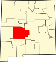
This is a locator map showing Socorro County in New Mexico.
David Benbennick made this map. For more information, see Commons:United States county locator maps. Or see any of the New Mexico county locator maps: Bernalillo · Catron · Chaves · Cibola · Colfax · Curry · De Baca · Doña Ana · Eddy · Grant · Guadalupe · Harding · Hidalgo · Lea · Lincoln · Los Alamos · Luna · McKinley · Mora · Otero · Quay · Rio Arriba · Roosevelt · Sandoval · San Juan · San Miguel · Santa Fe · Sierra · Socorro · Taos · Torrance · Union · Valencia.
| I, the copyright holder of this work, release this work into the public domain. This applies worldwide. In some countries this may not be legally possible; if so: I grant anyone the right to use this work for any purpose, without any conditions, unless such conditions are required by law. |
File history
Click on a date/time to view the file as it appeared at that time.
| Date/Time | Thumbnail | Dimensions | User | Comment | |
|---|---|---|---|---|---|
| current | 15:31, 12 February 2006 | | 5,677 × 6,312 (31 KB) | David Benbennick | {{subst:User:Dbenbenn/clm|county=Socorro County|state=New Mexico|type=county}} |
File usage
The following 2 pages use this file:
Global file usage
The following other wikis use this file:
- Usage on ar.wikipedia.org
- Usage on bg.wikipedia.org
- Usage on bpy.wikipedia.org
- Usage on cdo.wikipedia.org
- Usage on ceb.wikipedia.org
- Usage on ce.wikipedia.org
- Usage on cy.wikipedia.org
- Usage on de.wikipedia.org
- Usage on en.wikipedia.org
- Socorro County, New Mexico
- List of counties in New Mexico
- Alamo, New Mexico
- Magdalena, New Mexico
- Socorro, New Mexico
- Navajo Nation
- San Antonio, New Mexico
- Luis Lopez, New Mexico
- Acoma Indian Reservation
- Teypana
- Pilabó
- Senecú
- Template:Socorro County, New Mexico
- User:Nyttend/County templates/NM
- Polvadera, New Mexico
- National Register of Historic Places listings in Socorro County, New Mexico
- Category:Populated places in Socorro County, New Mexico
- Abeytas, New Mexico
- San Acacia, New Mexico
- Bernardo, New Mexico
- San Marcial, New Mexico
- Claunch, New Mexico
- La Joya, New Mexico
- Veguita, New Mexico
- San Antonito, Socorro County, New Mexico
- Lemitar, New Mexico
- Alamillo, New Mexico
- Chamizal, New Mexico
- Escondida, New Mexico
- Las Nutrias, New Mexico
- Dusty, New Mexico
- List of Navajo Nation Chapters
- Paraje, Socorro County, New Mexico
- Sabinal, Socorro County, New Mexico
- San Pascual Pueblo
- Canta Recio, New Mexico
- Adobe Ranch, Socorro County, New Mexico
View more global usage of this file.