
File:New Zealand relief map.jpg

Size of this preview: 475 × 599 pixels. Other resolutions: 190 × 240 pixels | 380 × 480 pixels | 609 × 768 pixels | 1,200 × 1,514 pixels.
Original file (1,200 × 1,514 pixels, file size: 185 KB, MIME type: image/jpeg)
| This is a file from the Wikimedia Commons. Information from its description page there is shown below. Commons is a freely licensed media file repository. You can help. |
Summary
| Description |
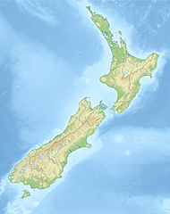
Deutsch: Positionskarte von Neuseeland
Quadratische Plattkarte, N-S-Streckung 120 %. Geographische Begrenzung der Karte: * N: 34.0° S * S: 48.3° S * W: 165.8° O * O: 179.4° O English: Location map of New Zealand
Equirectangular projection, N/S stretching 120 %. Geographic limits of the map: * N: 34.0° S * S: 48.3° S * W: 165.8° E * E: 179.4° E |
| Date | (UTC) |
| Source |
|
| Author |
|
| Other versions |
Derivative works of this file: |
| This is a retouched picture, which means that it has been digitally altered from its original version. The original can be viewed here: New Zealand location map.svg:
|
Licensing
I, the copyright holder of this work, hereby publish it under the following licenses:
This file is licensed under the Creative Commons Attribution-Share Alike 3.0 Unported license.
- You are free:
- to share – to copy, distribute and transmit the work
- to remix – to adapt the work
- Under the following conditions:
- attribution – You must give appropriate credit, provide a link to the license, and indicate if changes were made. You may do so in any reasonable manner, but not in any way that suggests the licensor endorses you or your use.
- share alike – If you remix, transform, or build upon the material, you must distribute your contributions under the same or compatible license as the original.

|
Permission is granted to copy, distribute and/or modify this document under the terms of the GNU Free Documentation License, Version 1.2 or any later version published by the Free Software Foundation; with no Invariant Sections, no Front-Cover Texts, and no Back-Cover Texts. A copy of the license is included in the section entitled GNU Free Documentation License. |
You may select the license of your choice.
Original upload log
This image is a derivative work of the following images:
- File:New_Zealand_location_map.svg licensed with Cc-by-sa-3.0, GFDL
- 2009-08-13T17:15:46Z NordNordWest 1928x2432 (385078 Bytes) '
- 2008-09-02T20:22:10Z NordNordWest 1928x2432 (385116 Bytes) {{Information |Description= {{de|Positionskarte von [[:de:Neuseeland|Neuseeland]]}} Quadratische Plattkarte, N-S-Streckung 120 %. Geographische Begrenzung der Karte: * N: 34.0° S * S: 48.3° S * W: 165.8° O * O: 179.4° O {
Uploaded with derivativeFX
File history
Click on a date/time to view the file as it appeared at that time.
| Date/Time | Thumbnail | Dimensions | User | Comment | |
|---|---|---|---|---|---|
| current | 13:45, 20 October 2010 | | 1,200 × 1,514 (185 KB) | Виктор В | {{Information |Description={{de|Positionskarte von Neuseeland}} Quadratische Plattkarte, N-S-Streckung 120 %. Geographische Begrenzung der Karte: * N: 34.0° S * S: 48.3° S * W: 165.8° O * O: 179.4° O {{en|Location map of [[:en:New |
File usage
The following 7 pages use this file:
Global file usage
The following other wikis use this file:
- Usage on als.wikipedia.org
- Usage on an.wikipedia.org
- Aoraki
- Tititea
- Kawarau
- Rahotu
- Glaciar Franz Josef
- Glaciar Fox
- Maungawhau
- Owairaka
- Maungakiekie
- Pico Walter (Nueva Zelanda)
- Mirror Lakes
- Crown Range
- Kā Kamu-a-Hakitekura
- Pico Cecil
- Caldera de Rotorua
- Río Kawarau
- Río Shotover
- Río Arrow
- Río Cleddau
- Río Hollyford
- Río Eglinton
- Opuke
- Te Tapu-nui
- Double Cone
- Mont Tarawera
- Mont Tongariro
- Te-taumata-o-Hakitekura
- Pico Coronet
- Usage on ar.wikipedia.org
- Usage on ast.wikipedia.org
- Usage on as.wikipedia.org
- Usage on az.wikipedia.org
- Şablon:Yer xəritəsi Yeni Zelandiya
- Taumatafakatanqihanqakoauauotamateaturipukakapikimaunqahoronukupokaifenuakitanatahu
- Celliko boğazı
- Kolvill boğazı
- Kredok boğazı
- Kuk boğazı
- Frenc-Pass boğazı
- Pitt boğazı
- Fovo boğazı
- Tamaki boğazı
- Rangitoto boğazı
- Aupouri
- Rakiura Milli Parkı
- Şimal adası (Yeni Zelandiya)
- Cənub adası (Yeni Zelandiya)
- Stüart adası
- Kraysterçdə zəlzələ (2016)
- Ranqipo
View more global usage of this file.