
File:Newriverwatershed-1-.jpg

Size of this preview: 464 × 599 pixels. Other resolutions: 186 × 240 pixels | 372 × 480 pixels | 595 × 768 pixels | 793 × 1,024 pixels | 1,415 × 1,826 pixels.
Original file (1,415 × 1,826 pixels, file size: 511 KB, MIME type: image/jpeg)
| This is a file from the Wikimedia Commons. Information from its description page there is shown below. Commons is a freely licensed media file repository. You can help. |
Summary
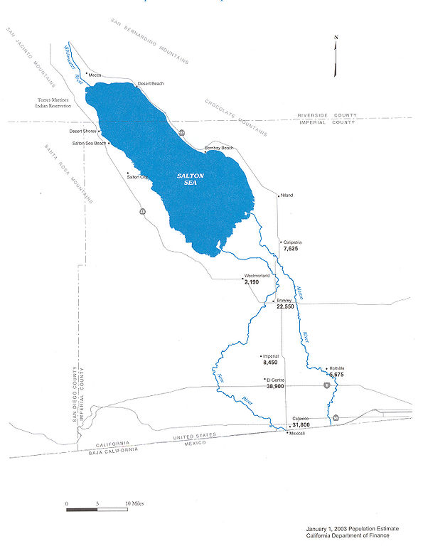
| Description |
Map of the New River — in Imperial County, Southern California.
|
| Date | |
| Source | Department of Water Resources |
| Author | DWR |
| Permission (Reusing this file) |
Public use |


Licensing

|
The copyright holder of this work allows anyone to use it for any purpose including unrestricted redistribution, commercial use, and modification.
Usage notes:
|
File history
Click on a date/time to view the file as it appeared at that time.
| Date/Time | Thumbnail | Dimensions | User | Comment | |
|---|---|---|---|---|---|
| current | 09:29, 20 May 2006 | | 1,415 × 1,826 (511 KB) | Cnrc | {{Information| |Description=From Mexicali to the Salton Sea, Communities Are at Risk Surface water in the New River is contaminated with metals, pesticides, VOC's, and bacteria. Pathogenic viruses have also been reported in the New River. Human exposur |
File usage
The following page uses this file:
Global file usage
The following other wikis use this file:
- Usage on ar.wikipedia.org
- Usage on arz.wikipedia.org
- Usage on ceb.wikipedia.org
- Usage on de.wikipedia.org
- Usage on en.wikipedia.org
- Usage on eo.wikipedia.org
- Usage on es.wikipedia.org
- Usage on fr.wikipedia.org
- Usage on he.wikipedia.org
- Usage on ja.wikipedia.org
- Usage on ml.wikipedia.org
- Usage on pt.wikipedia.org
- Usage on ru.wikipedia.org
- Usage on www.wikidata.org