
File:Piazza dei Signori (Vicenza).jpg

Size of this preview: 800 × 477 pixels. Other resolutions: 320 × 191 pixels | 640 × 381 pixels | 1,024 × 610 pixels | 1,280 × 763 pixels | 2,560 × 1,525 pixels | 7,360 × 4,385 pixels.
Original file (7,360 × 4,385 pixels, file size: 16.06 MB, MIME type: image/jpeg)
| This is a file from the Wikimedia Commons. Information from its description page there is shown below. Commons is a freely licensed media file repository. You can help. |
Summary
|
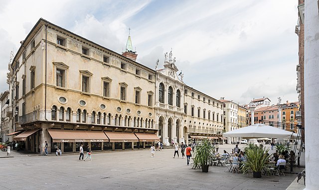
The Piazza dei Signori and the Monte Pietà - South West exposure - in Vicenza | |||||||||||||||||||
|
| |||||||||||||||||||

.jpg)

.jpg)
_-_facade_on_Piazza_dei_signori.jpg)
| Annotations | This image is annotated: View the annotations at Commons |
_-_Statue_of_the_Lion_of_Saint_Mark.jpg)
_-_Statue_of_the_Redeemer.jpg)
.jpg)
.jpg)
.jpg¶ms=045.547253_N_0011.546507_E_globe:Earth_class:object_type:object_region:IT_&language=en)
File history
Click on a date/time to view the file as it appeared at that time.
| Date/Time | Thumbnail | Dimensions | User | Comment | |
|---|---|---|---|---|---|
| current | 07:23, 20 August 2017 | | 7,360 × 4,385 (16.06 MB) | Archaeodontosaurus | {{Information |Description ={{en|1=c}} |Source ={{own}} |Author =Archaeodontosaurus |Date = |Permission = |other_versions = }} |
File usage
The following page uses this file:
Global file usage
The following other wikis use this file:
- Usage on arz.wikipedia.org
- Usage on en.wikipedia.org
- Usage on eo.wikivoyage.org
- Usage on es.wikipedia.org
- Usage on he.wikipedia.org
- Usage on it.wikipedia.org
- Usage on it.wikivoyage.org
- Usage on ja.wikipedia.org
- Usage on pl.wikipedia.org
- Usage on sl.wikipedia.org
- Usage on vec.wikipedia.org
- Usage on www.wikidata.org
.jpg)