
File:Rainy Lake.JPG

Size of this preview: 800 × 544 pixels. Other resolutions: 320 × 218 pixels | 640 × 436 pixels | 958 × 652 pixels.
Original file (958 × 652 pixels, file size: 130 KB, MIME type: image/jpeg)
| This is a file from the Wikimedia Commons. Information from its description page there is shown below. Commons is a freely licensed media file repository. You can help. |
Summary
| Description |
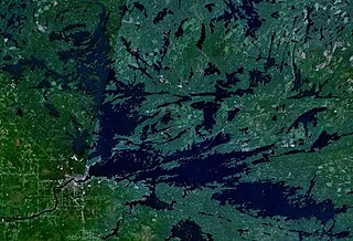
Українська: Супутникова світлина Дощового озера на основі програми World Wind (NASA)
English: Satellite photo Rainy Lake, based program World Wind (NASA) |
| Date | |
| Source | self work based on NASA World Wind |
| Author | self work |
| Camera location | | View this and other nearby images on: OpenStreetMap |
|---|
Licensing
| This image is in the public domain because it is a screenshot from NASA’s globe software World Wind using a public domain layer, such as Blue Marble, MODIS, Landsat, SRTM, USGS or GLOBE.
|
 |
File history
Click on a date/time to view the file as it appeared at that time.
| Date/Time | Thumbnail | Dimensions | User | Comment | |
|---|---|---|---|---|---|
| current | 18:26, 28 October 2010 | | 958 × 652 (130 KB) | Sparrov | {{Information |Description={{uk|1=Супутникова світлина Дощового озера на основі програми World Wind (NASA)}} {{en|1=Satellite photo Rainy Lake based program World Wind (NASA)}} |Source=self work based on NAS |
File usage
The following page uses this file:
Global file usage
The following other wikis use this file:
- Usage on bg.wikipedia.org
- Usage on de.wikipedia.org
- Usage on es.wikipedia.org
- Usage on fr.wikipedia.org
- Usage on ja.wikipedia.org
- Usage on nl.wikipedia.org
- Usage on no.wikipedia.org
- Usage on pl.wikipedia.org
- Usage on ru.wikipedia.org
- Usage on uk.wikipedia.org