
File:River Windrush - geograph.org.uk - 1341404.jpg
No higher resolution available.
River_Windrush_-_geograph.org.uk_-_1341404.jpg (640 × 457 pixels, file size: 387 KB, MIME type: image/jpeg)
| This is a file from the Wikimedia Commons. Information from its description page there is shown below. Commons is a freely licensed media file repository. You can help. |
Summary
| Description |
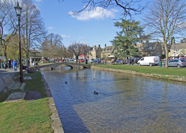
English: River Windrush This thirty six mile long Cotswold river is a tributary of the Thames. Downstream of Bourton on the Water, the river is a valuable trout stream. |
| Date | |
| Source | From geograph.org.uk |
| Author | Dennis Turner |
| Attribution (required by the license) | Dennis Turner / River Windrush / |
| Camera location | | View this and other nearby images on: OpenStreetMap |
|---|
_heading:315.00&language=en)
| Object location | | View this and other nearby images on: OpenStreetMap |
|---|
_heading:315.00&language=en)
Licensing

|
This image was taken from the Geograph project collection. See this photograph's page on the Geograph website for the photographer's contact details. The copyright on this image is owned by Dennis Turner and is licensed for reuse under the Creative Commons Attribution-ShareAlike 2.0 license.
|
This file is licensed under the Creative Commons Attribution-Share Alike 2.0 Generic license.
Attribution: Dennis Turner
- You are free:
- to share – to copy, distribute and transmit the work
- to remix – to adapt the work
- Under the following conditions:
- attribution – You must give appropriate credit, provide a link to the license, and indicate if changes were made. You may do so in any reasonable manner, but not in any way that suggests the licensor endorses you or your use.
- share alike – If you remix, transform, or build upon the material, you must distribute your contributions under the same or compatible license as the original.
File history
Click on a date/time to view the file as it appeared at that time.
| Date/Time | Thumbnail | Dimensions | User | Comment | |
|---|---|---|---|---|---|
| current | 05:25, 28 February 2011 | | 640 × 457 (387 KB) | GeographBot | == {{int:filedesc}} == {{Information |description={{en|1=River Windrush This thirty six mile long Cotswold river is a tributary of the Thames. Downstream of Bourton on the Water, the river is a valuable trout stream.}} |date=2009-03-29 |source=From [http: |
File usage
The following page uses this file:
Global file usage
The following other wikis use this file:
- Usage on en.wikipedia.org
- Usage on fa.wikipedia.org
- Usage on sv.wikipedia.org
- Usage on zh.wikipedia.org