
File:Roman Empire 69AD.PNG

Size of this preview: 800 × 548 pixels. Other resolutions: 320 × 219 pixels | 640 × 438 pixels | 1,024 × 701 pixels | 1,280 × 877 pixels | 1,600 × 1,096 pixels.
Original file (1,600 × 1,096 pixels, file size: 109 KB, MIME type: image/png)
| This is a file from the Wikimedia Commons. Information from its description page there is shown below. Commons is a freely licensed media file repository. You can help. |
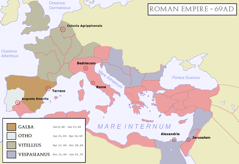
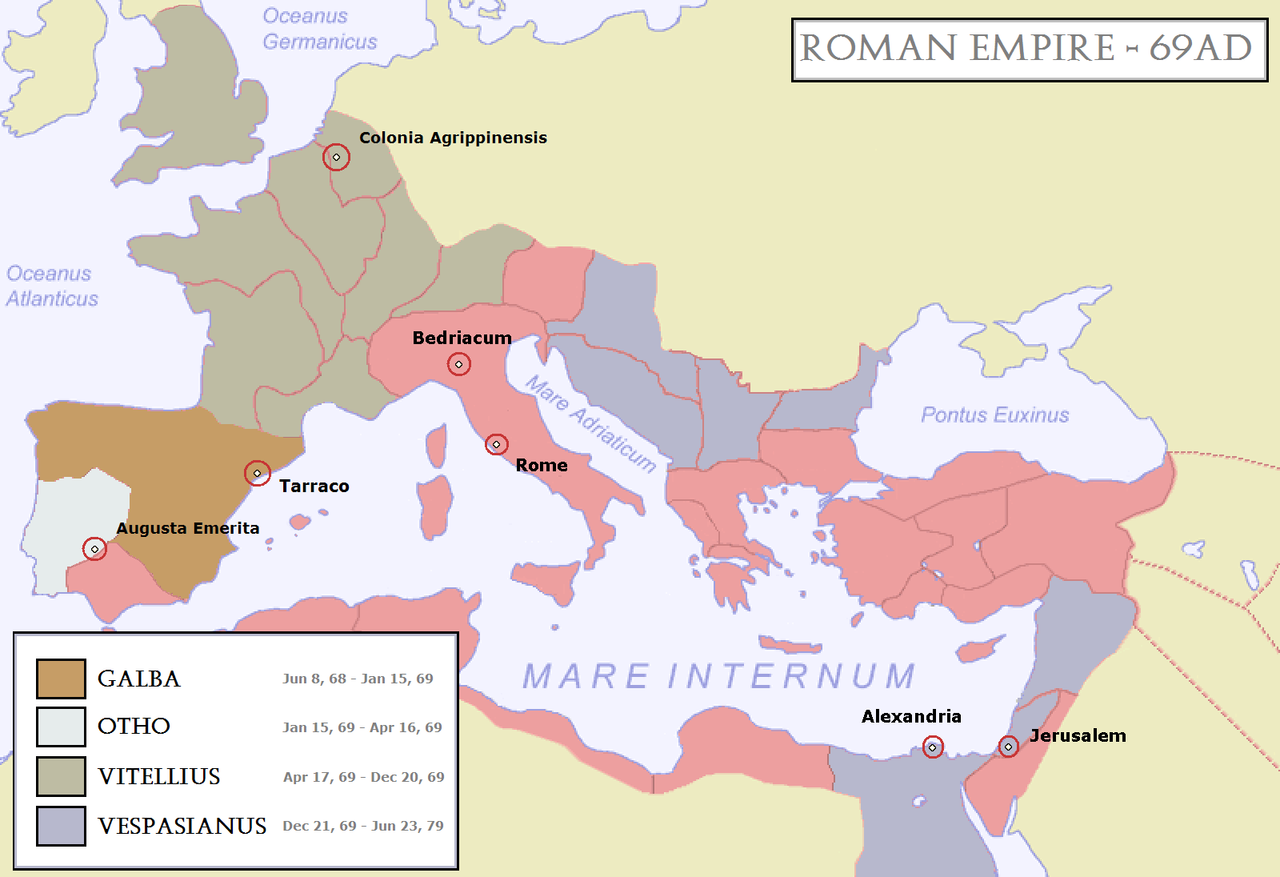
| Description | Map of the Roman Empire during 69AD, the Year of the Four Emperors. Coloured areas indicate provinces loyal to one of four warring generals. | ||||||||
| Date | |||||||||
| Source | Modified version of Image:Baleares SPQR.png | ||||||||
| Author | User:Steerpike | ||||||||
| Permission (Reusing this file) |
|
||||||||
| Other versions |
[]
|


.svg)


File history
Click on a date/time to view the file as it appeared at that time.
| Date/Time | Thumbnail | Dimensions | User | Comment | |
|---|---|---|---|---|---|
| current | 13:15, 3 January 2008 | | 1,600 × 1,096 (109 KB) | Steerpike | |
| 19:27, 30 December 2007 |  | 1,600 × 1,096 (110 KB) | Steerpike | ||
| 14:57, 24 December 2007 |  | 1,600 × 1,096 (100 KB) | Steerpike | ||
| 17:54, 23 December 2007 |  | 1,600 × 1,096 (60 KB) | Steerpike | {{Information |Description= Map of the Roman Empire during 69AD, the Year of the Four Emperors. Coloured areas indicate provinces loyal to one of four warring generals. |Source= Modified version of Image:Baleares SPQR.png |Date= 23-12-2007 |Author= [ |
File usage
The following page uses this file:
Global file usage
The following other wikis use this file:
- Usage on ar.wikipedia.org
- Usage on bg.wikipedia.org
- Usage on bs.wikipedia.org
- Usage on ca.wikipedia.org
- Usage on cs.wikipedia.org
- Usage on cy.wikipedia.org
- Usage on en.wikipedia.org
- Usage on eo.wikipedia.org
- Usage on fr.wikipedia.org
- Usage on hr.wikipedia.org
- Usage on ka.wikipedia.org
- Usage on la.wikipedia.org
- Usage on lt.wikipedia.org
- Usage on pl.wikipedia.org
- Usage on pt.wikipedia.org
- Usage on ru.wikipedia.org
- Usage on sh.wikipedia.org
- Usage on vi.wikipedia.org
- Usage on www.wikidata.org
- Usage on zh.wikipedia.org