
File:Saulgrub 2008-CC-BY-SA SYNTAXYS-Achim-Lammerts.jpg
No higher resolution available.
Saulgrub_2008-CC-BY-SA_SYNTAXYS-Achim-Lammerts.jpg (800 × 532 pixels, file size: 210 KB, MIME type: image/jpeg)
| This is a file from the Wikimedia Commons. Information from its description page there is shown below. Commons is a freely licensed media file repository. You can help. |
Summary
| Description |
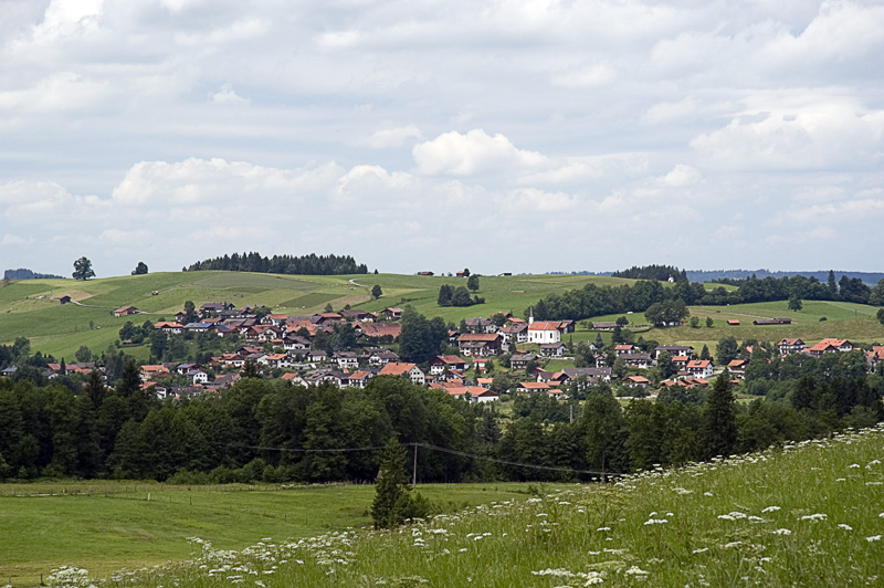
English: Exposure of Saulgrub in region Oberland, Bavaria, Germany. View from Sonnen/Kraggenau to NW direction.
Deutsch: Aufnahme der Ortschaft Saulgrub im Bayrischen Oberland. Blick nach NW aus der Nähe Sonnen/Kraggenau. |
| Date | |
| Source | Own work |
| Author | Syntaxys |
| Camera location | | View this and other nearby images on: OpenStreetMap |
|---|
Licensing
I, the copyright holder of this work, hereby publish it under the following licenses:

|
Permission is granted to copy, distribute and/or modify this document under the terms of the GNU Free Documentation License, Version 1.2 or any later version published by the Free Software Foundation; with no Invariant Sections, no Front-Cover Texts, and no Back-Cover Texts. A copy of the license is included in the section entitled GNU Free Documentation License. |
This file is licensed under the Creative Commons Attribution-Share Alike 3.0 Unported license.
- You are free:
- to share – to copy, distribute and transmit the work
- to remix – to adapt the work
- Under the following conditions:
- attribution – You must give appropriate credit, provide a link to the license, and indicate if changes were made. You may do so in any reasonable manner, but not in any way that suggests the licensor endorses you or your use.
- share alike – If you remix, transform, or build upon the material, you must distribute your contributions under the same or compatible license as the original.
You may select the license of your choice.
File history
Click on a date/time to view the file as it appeared at that time.
| Date/Time | Thumbnail | Dimensions | User | Comment | |
|---|---|---|---|---|---|
| current | 12:20, 6 July 2008 | | 800 × 532 (210 KB) | Syntaxys | {{Information |Description={{en|1=Exposure of Saulgrub in region Oberland, Bavaria, Germany. View from Sonnen/Kraggenau to NW direction.}} {{de|1=Aufnahme der Ortschaft Saulgrub im Bayrischen Oberland. Blick nach NW aus der Nähe Sonnen/Kraggenau.}} |Sour |
File usage
The following page uses this file:
Global file usage
The following other wikis use this file:
- Usage on an.wikipedia.org
- Usage on ceb.wikipedia.org
- Usage on ce.wikipedia.org
- Usage on da.wikipedia.org
- Usage on de.wikipedia.org
- Usage on de.wikivoyage.org
- Usage on en.wikipedia.org
- Usage on es.wikipedia.org
- Usage on eu.wikipedia.org
- Usage on hu.wikipedia.org
- Usage on hy.wikipedia.org
- Usage on ie.wikipedia.org
- Usage on it.wikipedia.org
- Usage on ku.wikipedia.org
- Usage on ky.wikipedia.org
- Usage on lld.wikipedia.org
- Usage on lmo.wikipedia.org
- Usage on pl.wikipedia.org
- Usage on pl.wikivoyage.org
- Usage on pt.wikipedia.org
- Usage on ro.wikipedia.org
- Usage on ru.wikipedia.org
- Usage on sr.wikipedia.org
- Usage on sv.wikipedia.org
- Usage on tt.wikipedia.org
- Usage on uk.wikipedia.org
- Usage on uz.wikipedia.org
- Usage on vi.wikipedia.org
- Usage on www.wikidata.org