
File:Survey monument JF00-072 from W 2.JPG

Size of this preview: 800 × 398 pixels. Other resolutions: 320 × 159 pixels | 640 × 319 pixels | 1,024 × 510 pixels | 1,280 × 637 pixels | 2,336 × 1,163 pixels.
Original file (2,336 × 1,163 pixels, file size: 1.09 MB, MIME type: image/jpeg)
| This is a file from the Wikimedia Commons. Information from its description page there is shown below. Commons is a freely licensed media file repository. You can help. |
Summary
| Description |
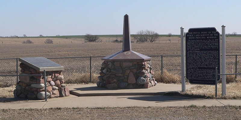
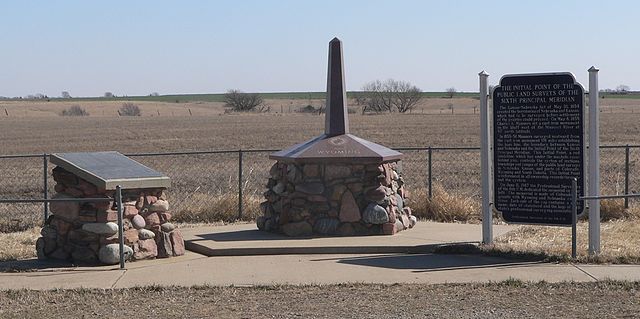
English: Survey monument JF00-072, located on Nebraska-Kansas state line at intersection of Nebraska counties Thayer and Jefferson and Kansas counties Washington and Republic; marking the intersection of 40 degrees north latitude and the Sixth Principal Meridian. Monuments and historical marker, seen from the west. |
| Date | |
| Source | Own work |
| Author | Ammodramus |
Licensing
I, the copyright holder of this work, hereby publish it under the following license:
| This file is made available under the Creative Commons CC0 1.0 Universal Public Domain Dedication. | |
| The person who associated a work with this deed has dedicated the work to the public domain by waiving all of their rights to the work worldwide under copyright law, including all related and neighboring rights, to the extent allowed by law. You can copy, modify, distribute and perform the work, even for commercial purposes, all without asking permission.
|
File history
Click on a date/time to view the file as it appeared at that time.
| Date/Time | Thumbnail | Dimensions | User | Comment | |
|---|---|---|---|---|---|
| current | 13:35, 19 March 2012 | | 2,336 × 1,163 (1.09 MB) | Ammodramus |
File usage
The following page uses this file:
Global file usage
The following other wikis use this file:
- Usage on de.wikipedia.org
- Usage on en.wikipedia.org
- Usage on fa.wikipedia.org
- Usage on he.wikipedia.org
- Usage on la.wikipedia.org
- Usage on vi.wikipedia.org