
File:Thetzarsmosque.PNG
No higher resolution available.
Thetzarsmosque.PNG (424 × 285 pixels, file size: 283 KB, MIME type: image/png)
| This is a file from the Wikimedia Commons. Information from its description page there is shown below. Commons is a freely licensed media file repository. You can help. |
Summary
| Description |
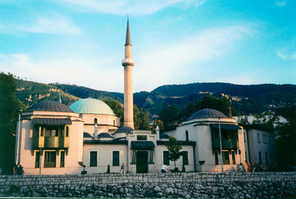
English: Taken by user Asim Led |
| Date | 31 October 2004 (original upload date) |
| Source | Transferred from en.wikipedia to Commons. |
| Author | The original uploader was Asim Led at English Wikipedia. |
| Camera location | | View this and other nearby images on: OpenStreetMap |
|---|
Licensing
| This file is licensed under the Creative Commons Attribution-Share Alike 3.0 Unported license. Subject to disclaimers. | ||
| ||
| This licensing tag was added to this file as part of the GFDL licensing update. |

|
Permission is granted to copy, distribute and/or modify this document under the terms of the GNU Free Documentation License, Version 1.2 or any later version published by the Free Software Foundation; with no Invariant Sections, no Front-Cover Texts, and no Back-Cover Texts. A copy of the license is included in the section entitled GNU Free Documentation License. Subject to disclaimers. |
Original upload log
The original description page was here. All following user names refer to en.wikipedia.
- 2004-10-31 18:05 Asim Led 424×285×8 (290108 bytes)
File history
Click on a date/time to view the file as it appeared at that time.
| Date/Time | Thumbnail | Dimensions | User | Comment | |
|---|---|---|---|---|---|
| current | 19:27, 29 February 2008 | | 424 × 285 (283 KB) | Matthiasb | {{Information |Description={{en|Taken by user Asim Led en:Category:Images of the Federation of Bosnia and Herzegovina}} |Source=Transferred from [http://en.wikipedia.org en.wikipedia] |Date=2004-10-31 (original upload date) |Author=Original uploade |
File usage
The following page uses this file:
Global file usage
The following other wikis use this file:
- Usage on ar.wikipedia.org
- مسجد علي باشا
- الإسلام في البوسنة والهرسك
- قالب:مساجد في البوسنة والهرسك
- قائمة مساجد حول العالم
- جامع الغازي خسرو بك
- مسجد فرحات باشا
- مسجد الملك فهد (سراييفو)
- بوابة:مساجد/قوالب
- مسجد الاستقلال (سراييفو)
- مسجد الإمبراطور
- مسجد آرنوديا
- مسجد بيت السلام
- مسجد فرحات باشا (سراييفو)
- مسجد كركوز بك
- مسجد الحاج أحمد دوكات
- مسجد وكيل الخراج
- Usage on arz.wikipedia.org
- Usage on ba.wikipedia.org
- Usage on be.wikipedia.org
- Usage on bg.wikipedia.org
- Usage on bn.wikipedia.org
- Usage on bs.wikipedia.org
- Usage on en.wikipedia.org
- Usage on en.wikivoyage.org
- Usage on es.wikipedia.org
- Usage on fa.wikipedia.org
- Usage on fr.wikipedia.org
- Usage on he.wikipedia.org
- Usage on hr.wikipedia.org
- Usage on it.wikipedia.org
- Usage on mk.wikipedia.org
- Usage on ms.wikipedia.org
- Usage on nl.wikipedia.org
- Usage on pl.wikipedia.org
View more global usage of this file.