
File:Titan sea map.png

Size of this preview: 800 × 583 pixels. Other resolutions: 320 × 233 pixels | 640 × 467 pixels | 1,024 × 747 pixels | 1,240 × 904 pixels.
Original file (1,240 × 904 pixels, file size: 44 KB, MIME type: image/png)
| This is a file from the Wikimedia Commons. Information from its description page there is shown below. Commons is a freely licensed media file repository. You can help. |
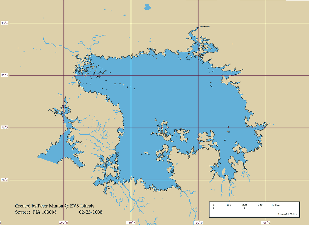
| Description | A map showing en:Ligeia Mare on Titan. Converted to PNG by uploader. The longitudes are 180° off, see [1]. | ||
| Date | |||
| Source | https://www.flickr.com/photos/evsmap/2287372411/ based off of PIA 100008 | ||
| Author | Peter Minton | ||
| Permission (Reusing this file) |
This file is licensed under the Creative Commons Attribution 2.0 Generic license.
|
||
| Other versions | Image:Titan sea map without grid.png |
File history
Click on a date/time to view the file as it appeared at that time.
| Date/Time | Thumbnail | Dimensions | User | Comment | |
|---|---|---|---|---|---|
| current | 18:14, 3 March 2008 | | 1,240 × 904 (44 KB) | Bryan Derksen | {{Information |Description=A map showing one of the unnamed seas of Titan. Converted to PNG by uploader. |Source=http://www.flickr.com/photos/evsmap/2287372411/ based off of PIA 100008 |Date=February 24 2008 |Author=Peter Minton |Permission={{cc-by-2.0}} |
File usage
The following page uses this file:
Global file usage
The following other wikis use this file:
- Usage on be.wikipedia.org
- Usage on ca.wikipedia.org
- Usage on cs.wikipedia.org
- Usage on de.wikipedia.org
- Usage on en.wikipedia.org
- Usage on fr.wikipedia.org
- Usage on gl.wikipedia.org
- Usage on id.wikipedia.org
- Usage on it.wikipedia.org
- Usage on ja.wikipedia.org
- Usage on lb.wikipedia.org
- Usage on pl.wikipedia.org
- Usage on pt.wikipedia.org
- Usage on ru.wikipedia.org
- Usage on zh.wikipedia.org