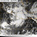
File:Tropical Storm Lester (2004).jpg

Size of this preview: 600 × 600 pixels. Other resolutions: 240 × 240 pixels | 480 × 480 pixels | 768 × 768 pixels | 1,024 × 1,024 pixels.
Original file (1,024 × 1,024 pixels, file size: 720 KB, MIME type: image/jpeg)
File history
Click on a date/time to view the file as it appeared at that time.
| Date/Time | Thumbnail | Dimensions | User | Comment | |
|---|---|---|---|---|---|
| current | 22:38, 3 June 2012 |  | 1,024 × 1,024 (720 KB) | Supportstorm | Removed Lines |
| 14:56, 24 September 2006 |  | 898 × 898 (249 KB) | Good kitty | ||
| 18:40, 6 July 2006 |  | 1,024 × 1,024 (256 KB) | Hurricanehink | {{Information |Description=Tropical Storm Lester near its Mexican landfall |Source=http://www.nrlmry.navy.mil/tc-bin/tc_display.cgi?BASIN=EPAC&STORM_NAME=15E.LESTER&ACTION=Latest_Photos&ACTIVES=None&MOSAIC_SCALE=20&PHOT=yes&ATCF_BASIN=ep&CGI=TC&AGE=Prev&A |
File usage
The following page uses this file:
Global file usage
The following other wikis use this file:
- Usage on de.wikipedia.org
- Usage on en.wikipedia.org
- Usage on pt.wikipedia.org
- Usage on zh.wikipedia.org

