
File:ValcourIslandMap1776Detail.jpg

Size of this preview: 541 × 599 pixels. Other resolutions: 217 × 240 pixels | 434 × 480 pixels | 803 × 889 pixels.
Original file (803 × 889 pixels, file size: 337 KB, MIME type: image/jpeg)
| This is a file from the Wikimedia Commons. Information from its description page there is shown below. Commons is a freely licensed media file repository. You can help. |
Summary
| Description |
English:

|
||||||||||||||||||||||
| Date | |||||||||||||||||||||||
| Source |
From the Boston Public Library Digital Maps Collection (http://maps.bpl.org/). |
||||||||||||||||||||||
| Author |
|
||||||||||||||||||||||
Licensing
|
This work is in the public domain in its country of origin and other countries and areas where the copyright term is the author's life plus 100 years or fewer. | |
| This file has been identified as being free of known restrictions under copyright law, including all related and neighboring rights. | |
File history
Click on a date/time to view the file as it appeared at that time.
| Date/Time | Thumbnail | Dimensions | User | Comment | |
|---|---|---|---|---|---|
| current | 21:29, 17 February 2009 | | 803 × 889 (337 KB) | Magicpiano | Higher-res version. |
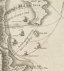
| 21:23, 17 February 2009 |  | 189 × 214 (23 KB) | Magicpiano | {{Information |Description={{en|1=thumb|right|source map showing area detailed in this image This is a blowup of the area highlighted in the map shown to the right, showing the detail of the action in the [[w:Bat |
File usage
The following page uses this file:
Global file usage
The following other wikis use this file:
- Usage on ca.wikipedia.org
- Usage on de.wikipedia.org
- Usage on en.wikipedia.org
- Usage on es.wikipedia.org
- Usage on fi.wikipedia.org
- Usage on fr.wikipedia.org
- Usage on it.wikipedia.org
- Usage on ja.wikipedia.org
- Usage on no.wikipedia.org
- Usage on ru.wikipedia.org
- Usage on www.wikidata.org