
File:Verlaufskarte Lahn.png
Size of this preview: 664 × 600 pixels. Other resolutions: 266 × 240 pixels | 532 × 480 pixels | 851 × 768 pixels | 1,134 × 1,024 pixels | 2,101 × 1,897 pixels.
Original file (2,101 × 1,897 pixels, file size: 6.43 MB, MIME type: image/png)
| This is a file from the Wikimedia Commons. Information from its description page there is shown below. Commons is a freely licensed media file repository. You can help. |
Summary
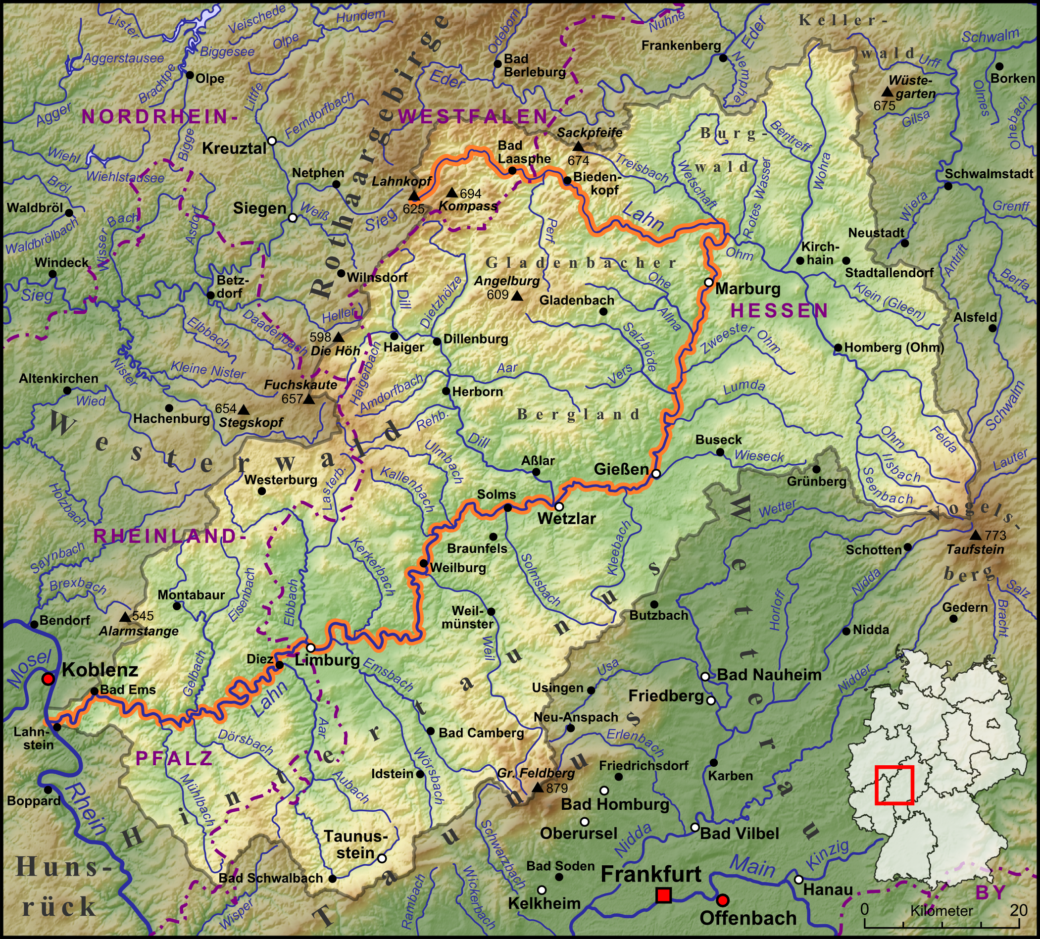
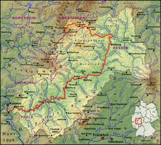
| Description | Die Lahn, ihre Nebenflüsse und das Wassereinzugsgebiet begrenzt durch die Wasserscheiden |
| Date | |
| Source |
own work, used:
|
| Author | Lencer |

|
This map has been made or improved in the German Kartenwerkstatt (Map Lab). You can propose maps to improve as well.
|
Licensing
I, the copyright holder of this work, hereby publish it under the following license:
This file is licensed under the Creative Commons Attribution-Share Alike 3.0 Unported license.
- You are free:
- to share – to copy, distribute and transmit the work
- to remix – to adapt the work
- Under the following conditions:
- attribution – You must give appropriate credit, provide a link to the license, and indicate if changes were made. You may do so in any reasonable manner, but not in any way that suggests the licensor endorses you or your use.
- share alike – If you remix, transform, or build upon the material, you must distribute your contributions under the same or compatible license as the original.
File history
Click on a date/time to view the file as it appeared at that time.
| Date/Time | Thumbnail | Dimensions | User | Comment | |
|---|---|---|---|---|---|
| current | 11:28, 2 December 2013 | | 2,101 × 1,897 (6.43 MB) | Lencer | Kelheim => Kelkheim |
| 11:12, 27 November 2013 |  | 1,500 × 1,354 (3.49 MB) | Lencer | + bundesländergrenzen | |
| 19:10, 21 November 2013 |  | 1,500 × 1,354 (3.48 MB) | Lencer | completely reworked version, includig water entering area und new relief | |
| 20:35, 10 January 2013 |  | 1,500 × 1,302 (3.25 MB) | Lencer | + Hachenburg | |
| 12:16, 24 October 2012 |  | 1,500 × 1,302 (3.25 MB) | Lencer | Frohnhausen => Fronhausen | |
| 13:12, 24 April 2009 |  | 1,500 × 1,302 (3.25 MB) | Lencer | fix | |
| 13:06, 24 April 2009 |  | 1,491 × 1,295 (3.22 MB) | Lencer | diverse ergänzungen | |
| 12:21, 24 April 2009 |  | 1,500 × 1,302 (3.24 MB) | Lencer | dautphe ergänzt | |
| 11:39, 24 April 2009 |  | 1,500 × 1,302 (3.24 MB) | Lencer | == Beschreibung == {{Information |Description=Die Lahn und ihre Nebenflüsse |Source=own work, used: * http://www.openstreetmap.org * [http://www2.demis.nl/wms/mapclip.htm Demis Webserver] * Generic Mapping Tools |Date=April 2009 |Author=[[Us |
File usage
The following page uses this file:
Global file usage
The following other wikis use this file:
- Usage on af.wikipedia.org
- Usage on an.wikipedia.org
- Usage on bg.wikipedia.org
- Usage on ca.wikipedia.org
- Usage on ceb.wikipedia.org
- Usage on cs.wikipedia.org
- Usage on da.wikipedia.org
- Usage on de.wikipedia.org
- Usage on en.wikipedia.org
- Usage on en.wikivoyage.org
- Usage on eo.wikipedia.org
- Usage on es.wikipedia.org
- Usage on et.wikipedia.org
- Usage on fa.wikipedia.org
- Usage on fi.wikipedia.org
- Usage on fr.wikipedia.org
- Usage on fy.wikipedia.org
- Usage on gl.wikipedia.org
- Usage on hr.wikipedia.org
- Usage on hu.wikipedia.org
- Usage on it.wikipedia.org
- Usage on ja.wikipedia.org
- Usage on ko.wikipedia.org
- Usage on la.wikipedia.org
- Usage on lb.wikipedia.org
- Usage on mk.wikipedia.org
- Usage on nds.wikipedia.org
- Usage on nl.wikipedia.org
- Usage on no.wikipedia.org
- Usage on oc.wikipedia.org
- Usage on pl.wikipedia.org
- Usage on pt.wikipedia.org
- Usage on ro.wikipedia.org
- Usage on ru.wikipedia.org
View more global usage of this file.