
File:Vischer - Topographia Ducatus Stiria - 110 Graz.jpg

Original file (2,394 × 1,566 pixels, file size: 2.17 MB, MIME type: image/jpeg)
| This is a file from the Wikimedia Commons. Information from its description page there is shown below. Commons is a freely licensed media file repository. You can help. |
Summary
| Description |
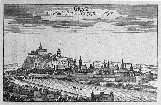
G. M. Vischers Käyserlichen Geographi, Topographia Ducatus Stiriae, Das ist: Eigentliche Delineation / und Abbildung aller Städte / Schlösser / Marcktfleck / Lustgärten / Probsteyen / Stiffter / Clöster und Kirchen / so es sich im Herzogthumb Steyrmarck befinden; Und anjetzo Umb einen billichen Preyß zu finden seynd Bey Johann Bitsch Universitäts Buchhandlern / Auff dem Juden=Platz bey der guldenen Saulen. Graz 1681 Die Nummerierung der Dateien folgt der alphabetischen Reihung der Ortsnamen |
||||||||||||||||||||
| Date | |||||||||||||||||||||
| Source | Topographia Ducatus Stiriae | ||||||||||||||||||||
| Author |
|
||||||||||||||||||||

Licensing

|
Scanprojekt Community Projektbudget 2012
This document describes or depicts an object which is located in Austria today.
Send requests for uncompressed scans to Hubertl.
|

|
|
This work is in the public domain in its country of origin and other countries and areas where the copyright term is the author's life plus 100 years or fewer. | |
| This file has been identified as being free of known restrictions under copyright law, including all related and neighboring rights. | |
File history
Click on a date/time to view the file as it appeared at that time.
| Date/Time | Thumbnail | Dimensions | User | Comment | |
|---|---|---|---|---|---|
| current | 22:08, 1 November 2012 | | 2,394 × 1,566 (2.17 MB) | Hubertl |
File usage
There are no pages that use this file.
Global file usage
The following other wikis use this file:
- Usage on af.wikipedia.org
- Usage on ar.wikipedia.org
- Usage on ast.wikipedia.org
- Usage on be.wikipedia.org
- Usage on bg.wikipedia.org
- Usage on br.wikipedia.org
- Usage on bs.wikipedia.org
- Usage on ca.wikipedia.org
- Usage on cs.wikipedia.org
- Usage on cv.wikipedia.org
- Usage on cy.wikipedia.org
- Usage on da.wikipedia.org
- Usage on de.wikipedia.org
- Usage on el.wikipedia.org
- Usage on en.wikipedia.org
- Usage on es.wikipedia.org
- Usage on et.wikipedia.org
- Usage on eu.wikipedia.org
- Usage on fa.wikipedia.org
- Usage on fy.wikipedia.org
- Usage on ga.wikipedia.org
- Usage on gl.wikipedia.org
- Usage on he.wikipedia.org
- Usage on hr.wikipedia.org
- Usage on hy.wikipedia.org
- Usage on id.wikipedia.org
- Usage on is.wikipedia.org
- Usage on it.wikipedia.org
- Usage on ja.wikipedia.org
- Usage on jv.wikipedia.org
- Usage on ko.wikipedia.org
- Usage on ku.wikipedia.org
- Usage on la.wikipedia.org
- Usage on lmo.wikipedia.org
- Usage on lt.wikipedia.org
- Usage on ms.wikipedia.org
- Usage on mt.wikipedia.org
- Usage on nl.wikipedia.org
- Usage on nn.wikipedia.org
- Usage on no.wikipedia.org
- Usage on oc.wikipedia.org
- Usage on pl.wikipedia.org
- Usage on ps.wikipedia.org
- Usage on pt.wikipedia.org
- Usage on qu.wikipedia.org
- Usage on ro.wikipedia.org
- Usage on scn.wikipedia.org
View more global usage of this file.