
File:Watkins Glen International Track Map.svg

Size of this PNG preview of this SVG file: 450 × 229 pixels. Other resolutions: 320 × 163 pixels | 640 × 326 pixels | 1,024 × 521 pixels | 1,280 × 651 pixels | 2,560 × 1,303 pixels.
Original file (SVG file, nominally 450 × 229 pixels, file size: 60 KB)
| This is a file from the Wikimedia Commons. Information from its description page there is shown below. Commons is a freely licensed media file repository. You can help. |
Summary
| Description |
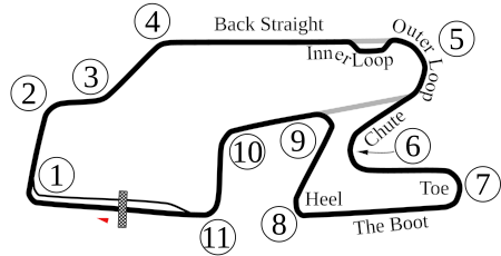
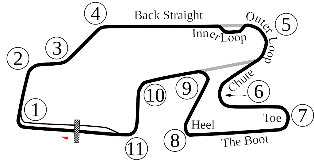
English: Vectorized old version of Image:Watkins Glen International Circuit Map.png. New version also adds the bus stop. |
| Date | 6-5-2008 |
| Source | Own work |
| Author | Will Pittenger |
| Other versions |
 |
| Camera location | | View this and other nearby images on: OpenStreetMap |
|---|
Licensing
| I, the copyright holder of this work, release this work into the public domain. This applies worldwide. In some countries this may not be legally possible; if so: I grant anyone the right to use this work for any purpose, without any conditions, unless such conditions are required by law. |
File history
Click on a date/time to view the file as it appeared at that time.
| Date/Time | Thumbnail | Dimensions | User | Comment | |
|---|---|---|---|---|---|
| current | 22:33, 15 October 2009 | | 450 × 229 (60 KB) | Spyder Monkey | Corrected corner numbers, converted text into paths for thumbnail display |
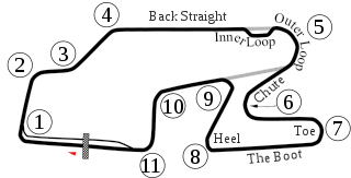
| 22:26, 15 October 2009 |  | 450 × 229 (37 KB) | Spyder Monkey | corrected corner names (inner loop, outer loop); added "Heel" of the boot | |
| 05:29, 6 June 2008 |  | 450 × 229 (77 KB) | Will Pittenger | Updated version that displays the text on paths that were supposed to be there. If you need to edit that text, please edit the older version. | |
| 05:22, 6 June 2008 |  | 450 × 229 (36 KB) | Will Pittenger | {{Information |Description={{en|1=Vectorized old version of Image:Watkins Glen International Circuit Map.png. New version also adds the bus stop.}} |Source=Own work by uploader |Author=Will Pittenger |Date=6-5-2008 |Permissio |
File usage
The following page uses this file:
Global file usage
The following other wikis use this file:
- Usage on af.wikipedia.org
- Usage on ast.wikipedia.org
- Usage on bn.wikipedia.org
- Usage on de.wikipedia.org
- Usage on en.wikipedia.org
- Watkins Glen International
- 1999 FIA GT Watkins Glen 3 Hours
- 2007 Camping World Watkins Glen Grand Prix
- 6 Hours of Watkins Glen
- 2008 Camping World Indy Grand Prix at the Glen
- 2009 Camping World Grand Prix at the Glen
- List of IMSA GT Championship circuits
- 2009 Six Hours of Watkins Glen
- 2009 Crown Royal 200 at the Glen
- List of IndyCar Series racetracks
- Crown Royal 200 at the Glen
- 2010 Camping World Grand Prix at The Glen
- List of GT World Challenge America circuits
- 2016 IndyCar Grand Prix at The Glen
- 2017 IndyCar Grand Prix at The Glen
- List of IMSA SportsCar Championship circuits
- 2019 6 Hours of The Glen
- 2017 6 Hours of The Glen
- 2021 6 Hours of The Glen
- 2021 WeatherTech 240 at The Glen
- 2022 Sahlen's Six Hours of The Glen
- 2018 6 Hours of The Glen
- 2023 Sahlen's Six Hours of The Glen
- Usage on es.wikipedia.org
- Usage on eu.wikipedia.org
- Usage on fa.wikipedia.org
- Usage on fi.wikipedia.org
- Usage on fr.wikipedia.org
- Usage on hr.wikipedia.org
- Usage on hu.wikipedia.org
- Usage on id.wikipedia.org
View more global usage of this file.