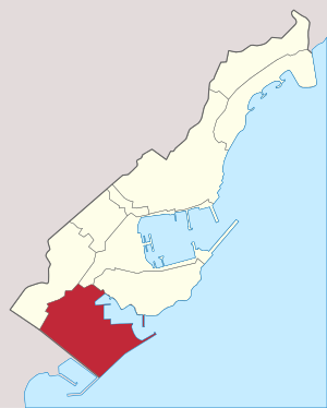
Fontvieille, Monaco
Fontvieille, Monaco | |
|---|---|
Ward of Monaco | |
 Harbour of Fontvielle | |
 Location in Monaco | |
| Coordinates: 43°43′46″N 7°24′54″E / 43.72944°N 7.41500°E | |
| Area | |
| • Total | 0.329516 km2 (0.127227 sq mi) |
| Population (2008) | |
| • Total | 3,602 |
| • Density | 10,931/km2 (28,310/sq mi) |
| Website | www.visitmonaco.com |
Fontvieille is the southernmost ward in the Principality of Monaco. It was developed by an Italian architect, Manfredi Nicoletti, between the 1970s and the 1990s.
Fontvieille is twinned with Santa Maria a Monte, Italy, since 1991.
