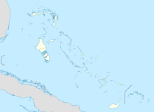
Grand Bahama International Airport
Grand Bahama International Airport | |||||||||||
|---|---|---|---|---|---|---|---|---|---|---|---|
| Summary | |||||||||||
| Airport type | Public | ||||||||||
| Owner | Hutchison Port Holdings and the Grand Bahama Port Authority | ||||||||||
| Operator | Grand Bahama Airport Company | ||||||||||
| Location | Freeport, Bahamas | ||||||||||
| Hub for | Passenger | ||||||||||
| Elevation AMSL | 8 ft / 2 m | ||||||||||
| Coordinates | 26°33′31″N 078°41′44″W / 26.55861°N 78.69556°W | ||||||||||
| Map | |||||||||||
| Runways | |||||||||||
| |||||||||||
Grand Bahama International Airport (GBIA) (IATA: FPO, ICAO: MYGF) is a privately owned international airport. It is in Freeport, Bahamas. The airport is a joint venture between Hutchison Port Holdings (HPH) and The Port Group (or the Grand Bahama Port Authority). It also has 741 acres (300 ha) of land. This adjoins it to the Freeport Harbour Company Limited. So, they work as one body, known as the Sea Air Business Centre (SABC).[2]
Grand Bahama International Airport is one of two Bahamian airports that has US border preclearance facilities.
The airport has a 3,359 m × 46 m (11,020 ft × 151 ft) runway. It can handle the largest aircraft in service. It is quite close to all major cities of the Eastern Seaboard of the United States.[3]
References[change | change source]
- ↑ Airport information for MYGF at World Aero Data. Data current as of October 2006.Source: DAFIF.
- ↑ http://www.freeportcontainerport.com/gbair.php Archived 2011-07-11 at the Wayback Machine Grand Bahama International Airport (GBIA) is a privately owned ...•Special Cargo/Freight handling area
- ↑ The distance from the Grand Bahama International Airport to major East Coast cities varies between 112 miles (180 km) (Miami) and 1,173 miles (1,888 km) (Boston). Flight time varies from 0.7 to 3 hours.

