
Hall Park, Oklahoma
Hall Park, Oklahoma | |
|---|---|
 Location of Hall Park, Oklahoma | |
| Coordinates: 35°14′27″N 97°24′25″W / 35.24083°N 97.40694°W | |
| Country | United States |
| State | Oklahoma |
| County | Cleveland |
| Area | |
| • Total | 1.1 sq mi (2.9 km2) |
| • Land | 1.1 sq mi (2.7 km2) |
| • Water | 0.1 sq mi (0.1 km2) |
| Elevation | 1,184 ft (361 m) |
| Population (2000) | |
| • Total | 1,088 |
| • Density | 1,027.2/sq mi (396.6/km2) |
| Time zone | UTC-6 (Central (CST)) |
| • Summer (DST) | UTC-5 (CDT) |
| FIPS code | 40-32100[1] |
| GNIS feature ID | 1093489[2] |
Hall Park is a neighborhood in Norman, Oklahoma. It was a separate town until 2003.[3]
References[change | change source]
- ↑ "U.S. Census website". United States Census Bureau. Retrieved 2008-01-31.
- ↑ "US Board on Geographic Names". United States Geological Survey. 2007-10-25. Retrieved 2008-01-31.
- ↑ "A city inside the city of Norman". News9.com. March 31, 2011. Retrieved March 25, 2024.
Other websites[change | change source]
Municipalities and communities of Cleveland County, Oklahoma, United States | ||
|---|---|---|
| Cities | 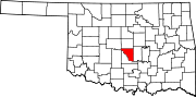 | |
| Towns | ||
| Neighborhood | ||
| Footnotes | ‡This populated place also has portions in an adjacent county or counties | |
