Hawalli Governorate
Hawalli Governorate
محافظة حولي | |
|---|---|
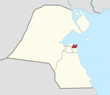
 Map of Kuwait with Hawalli highlighted | |
| Coordinates (Hawalli District): 29°18′20″N 48°01′51″E / 29.30556°N 48.03083°E | |
| Country | |
| Districts | 16 |
| Area | |
| • Total | 82 km2 (32 sq mi) |
| Population (June 2014)[1] | |
| • Total | 890,533 |
| • Density | 11,000/km2 (28,000/sq mi) |
| Time zone | UTC+03 (EAT) |
| ISO 3166 code | KW-HW |
The Hawalli Governorate (Arabic: محافظة حولي Muḥāfaẓat Ḥawalli) is one of the 6 governorates of Kuwait. It is made up of the following areas:
- Hawalli
- Bayan
- Mishref
- Maidan Hawalli
- Jabriya
- Rumaithiya
- Salmiya
- Salwa
- Shaab
- Al-Salam
- Hattin
- Al-Zahra
- Mubarak Al-Abdullah Al Jaber (West Mishref)
- Al-Shuhada
- Al-Badae
- Al-Siddiq
References[change | change source]
- ↑ "Statistical Reports". stat.paci.gov.kw. Archived from the original on 13 March 2014. Retrieved 31 August 2014.


