
Jennings, Kansas
Jennings, Kansas | |
|---|---|
 Location within Decatur County and Kansas | |
 | |
| Coordinates: 39°40′49″N 100°17′38″W / 39.68028°N 100.29389°W[1] | |
| Country | United States |
| State | Kansas |
| County | Decatur |
| Founded | 1870s |
| Platted | 1888 |
| Incorporated | 1906 |
| Named for | Warren Jennings |
| Area | |
| • Total | 0.27 sq mi (0.69 km2) |
| • Land | 0.27 sq mi (0.69 km2) |
| • Water | 0.00 sq mi (0.00 km2) |
| Elevation | 2,510 ft (770 m) |
| Population | |
| • Total | 81 |
| • Density | 300/sq mi (120/km2) |
| Time zone | UTC-6 (CST) |
| • Summer (DST) | UTC-5 (CDT) |
| ZIP code | 67643 |
| Area code | 785 |
| FIPS code | 20-35375 [1] |
| GNIS ID | 471077 [1] |
Jennings is a city in Decatur County, Kansas, United States. In 2020, 81 people lived there.[3]
History[change | change source]
The first post office at Jennings was created in 1874. The post office there was called Slab City until 1879.[4][5]
Jennings was planned out in 1888.[6][7] It was named after Warren Jennings, a landowner.[8][9]
Jennings was on the Chicago, Rock Island and Pacific Railroad.[10]
Geography[change | change source]
Jennings is at 39°40′49″N 100°17′38″W / 39.68028°N 100.29389°W (39.680197, -100.293918). The United States Census Bureau says that the city has a total area of 0.27 square miles (0.70 km2). All of it is land.[2]
People[change | change source]
| Historical population | |||
|---|---|---|---|
| Census | Pop. | %± | |
| 1910 | 259 | — | |
| 1920 | 253 | −2.3% | |
| 1930 | 344 | 36.0% | |
| 1940 | 311 | −9.6% | |
| 1950 | 330 | 6.1% | |
| 1960 | 292 | −11.5% | |
| 1970 | 224 | −23.3% | |
| 1980 | 194 | −13.4% | |
| 1990 | 188 | −3.1% | |
| 2000 | 146 | −22.3% | |
| 2010 | 96 | −34.2% | |
| 2020 | 81 | −15.6% | |
| U.S. Decennial Census | |||
2020 census[change | change source]
The 2020 census says that there were 81 people, 52 households, and 20 families living in Jennings. Of the households, 82.7% owned their home and 17.3% rented their home.
The median age was 53.5 years. Of the people, 91.4% were White, 3.7% were Native American, 2.5% were Black, and 2.5% were two or more races. None were Hispanic or Latino.[3][11]
2010 census[change | change source]
The 2010 census says that there were 96 people, 50 households, and 30 families living in Jennings.[12]
Education[change | change source]
Jennings is part of USD 294 Oberlin.[13]
References[change | change source]
- ↑ 1.0 1.1 1.2 1.3 "Jennings, Kansas". Geographic Names Information System. United States Geological Survey.
- ↑ 2.0 2.1 "2020 U.S. Gazetteer Files". United States Census Bureau. Retrieved November 17, 2023.
- ↑ 3.0 3.1 3.2 "DP1: PROFILE OF GENERAL POPULATION AND HOUSING CHARACTERISTICS". United States Census Bureau. Retrieved November 17, 2023.
- ↑ "Kansas Post Offices - Jennings". Kansas Historical Society. Retrieved 21 September 2017.
- ↑ "Kansas Post Offices - Slab City". Kansas Historical Society. Retrieved 21 September 2017.
- ↑ Blackmar, Frank Wilson (1912). Kansas: A Cyclopedia of State History. Standard Publishing Company. p. 27.
- ↑ "Decatur County". Blue Skyways. Kansas State Library. Archived from the original on 4 October 2012. Retrieved 7 June 2014.
- ↑ Kansas State Historical Society (1916). Biennial Report of the Board of Directors of the Kansas State Historical Society. Kansas State Printing Plant. p. 174.
- ↑ "Profile for Jennings, Kansas". ePodunk. Archived from the original on 14 July 2014. Retrieved 8 June 2014.
- ↑ Gannett, Henry (1898). A Gazetteer of Kansas. Govt. Print. Off. p. 119.
- ↑ "P16: HOUSEHOLD TYPE". United States Census Bureau. Retrieved December 31, 2023.
- ↑ "American FactFinder". United States Census Bureau. Retrieved 2012-07-06.
- ↑ "Oberlin USD 294". USD 294. Retrieved 7 January 2017.
Other websites[change | change source]
- City
- Schools
- USD 294, local school district
- Maps
- Jennings City Map, KDOT
Municipalities and communities of Decatur County, Kansas, United States | ||
|---|---|---|
| Cities | 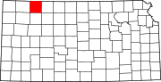 | |
| Unincorporated communities | ||
| Ghost towns | ||
| Townships | ||
| Footnotes | ‡This community also has portions in an adjacent county or counties. | |
