Kechi, Kansas
Kechi, Kansas | |
|---|---|
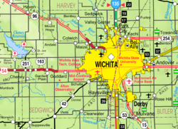
 Location within Sedgwick County and Kansas | |
 | |
| Coordinates: 37°47′43″N 97°16′43″W / 37.79528°N 97.27861°W[1] | |
| Country | United States |
| State | Kansas |
| County | Sedgwick |
| Founded | 1880s |
| Incorporated | 1957 |
| Named for | Kichai people |
| Area | |
| • Total | 6.08 sq mi (15.74 km2) |
| • Land | 6.03 sq mi (15.61 km2) |
| • Water | 0.05 sq mi (0.13 km2) |
| Elevation | 1,381 ft (421 m) |
| Population | |
| • Total | 2,217 |
| • Density | 360/sq mi (140/km2) |
| Time zone | UTC-6 (CST) |
| • Summer (DST) | UTC-5 (CDT) |
| ZIP code | 67067 |
| Area code | 316 |
| FIPS code | 20-36225 [1] |
| GNIS ID | 473859 [1] |
| Website | kechiks.gov |
Kechi /ˈkiːtʃaɪ/ is a city in Sedgwick County, Kansas, United States. It is a suburb of Wichita. In 2020, 2,217 people lived there.[3]
History[change | change source]

Kechi was named after the Kichai people.[4]
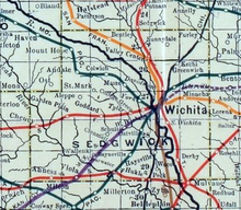
In 1887, the Chicago, Kansas and Nebraska Railway built a railroad north-south from Herington through Kechi to Caldwell.[5] It closed in 1891. The Chicago, Rock Island and Pacific Railway then owned it, but it closed in 1980. It reorganized as Oklahoma, Kansas and Texas Railroad. It merged in 1988 with Missouri Pacific Railroad. It merged again in 1997 with Union Pacific Railroad. Most people still call this railroad the "Rock Island".
The first post office in Kechi was created in 1888.[6]
Geography[change | change source]
Kechi is at 37°47′43″N 97°16′43″W / 37.795228°N 97.278660°W (37.795228, -97.278660).[7] The United States Census Bureau says that the city has a total area of 6.08 square miles (15.75 km2)>. Of that, 6.03 square miles (15.62 km2) is land and 0.05 square miles (0.13 km2) is water.[2]
People[change | change source]
| Historical population | |||
|---|---|---|---|
| Census | Pop. | %± | |
| 1960 | 245 | — | |
| 1970 | 229 | −6.5% | |
| 1980 | 288 | 25.8% | |
| 1990 | 517 | 79.5% | |
| 2000 | 1,038 | 100.8% | |
| 2010 | 1,909 | 83.9% | |
| 2020 | 2,217 | 16.1% | |
| U.S. Decennial Census | |||
Kechi is part of the Wichita, KS Metropolitan Statistical Area.
2020 census[change | change source]
The 2020 census says that there were 2,217 people, 840 households, and 661 families living in Kechi. Of the households, 82.4% owned their home and 17.6% rented their home.
The median age was 41.2 years. Of the people, 82.9% were White, 4.6% were Black, 2.0% were Asian, 1.0% were Native American, 2.5% were from some other race, and 6.9% were two or more races. Hispanic or Latino of any race were 5.9% of the people.[3][8]
2010 census[change | change source]
The 2010 census says that there were 1,909 people, 701 households, and 566 families living in Kechi.[9]
References[change | change source]
- ↑ 1.0 1.1 1.2 1.3 "Kechi, Kansas". Geographic Names Information System. United States Geological Survey.
- ↑ 2.0 2.1 "2020 U.S. Gazetteer Files". United States Census Bureau. Retrieved December 8, 2023.
- ↑ 3.0 3.1 3.2 "DP1: PROFILE OF GENERAL POPULATION AND HOUSING CHARACTERISTICS". United States Census Bureau. Retrieved December 8, 2023.
- ↑ "City History". City of Kechi, Kansas. Archived from the original on 9 November 2014. Retrieved 12 June 2014.
- ↑ "Rock Island Rail History". Archived from the original on 2011-06-19. Retrieved 2019-11-21.
- ↑ "Kansas Post Offices, 1828-1961". Kansas Historical Society. Archived from the original on 9 October 2013. Retrieved 10 June 2014.
- ↑ "US Gazetteer files: 2010, 2000, and 1990". United States Census Bureau. 2011-02-12. Retrieved 2011-04-23.
- ↑ "P16: HOUSEHOLD TYPE". United States Census Bureau. Retrieved December 31, 2023.
- ↑ "American FactFinder". United States Census Bureau. Retrieved 2012-07-06.
Other websites[change | change source]
- City
- Schools
- Maps
- Kechi City Map, KDOT

